MyTopo
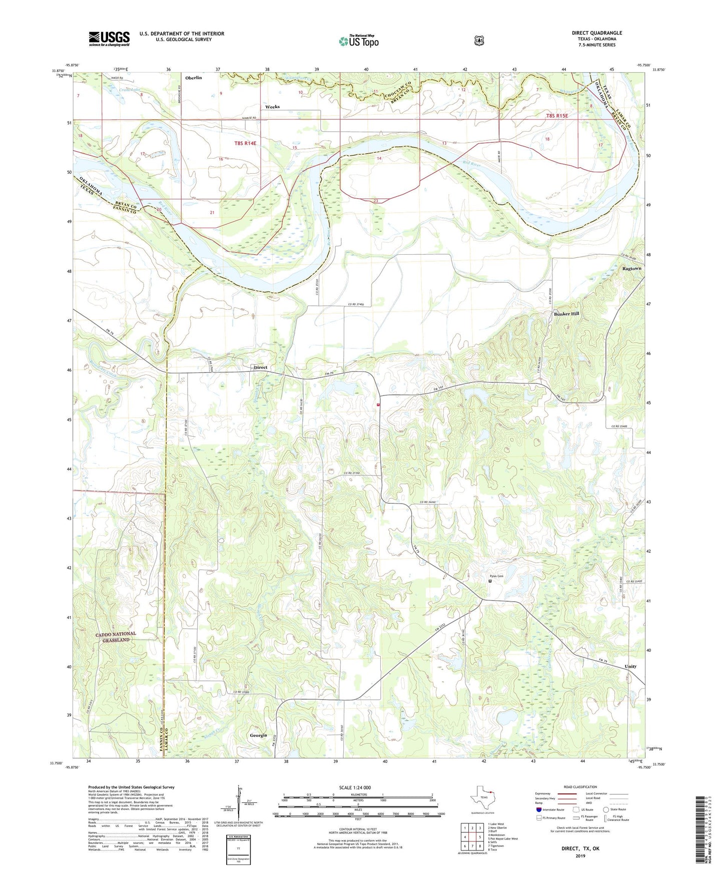
Direct Texas US Topo Map
Couldn't load pickup availability
Also explore the Direct Forest Service Topo of this same quad for updated USFS data
2022 topographic map quadrangle Direct in the states of Texas, Oklahoma. Scale: 1:24000. Based on the newly updated USGS 7.5' US Topo map series, this map is in the following counties: Lamar, Bryan, Fannin, Choctaw. The map contains contour data, water features, and other items you are used to seeing on USGS maps, but also has updated roads and other features. This is the next generation of topographic maps. Printed on high-quality waterproof paper with UV fade-resistant inks.
Quads adjacent to this one:
West: Monkstown
Northwest: Lake West
North: New Oberlin
Northeast: Bluff
East: Pat Mayse Lake West
Southeast: Toco
South: Tigertown
Southwest: Selfs
This map covers the same area as the classic USGS quad with code o33095g7.
Contains the following named places: Bois d'Arc Creek, Bunker Hill, Carson Branch, Church of Christ, Corinth Church, Crane Lake, Direct, Direct School, Direct Volunteer Fire Department, Dry Creek, East Direct, Georgia, Mays Prairie Church, Oberlin, Oberlin Ferry, Oberlin Lake, Pyles Cemetery, Q B Stephens Lower Lake, Q B Stephens Lower Lake Dam, Shooter Creek, Slough Creek, Soil Conservation Service Site 1 Dam, Soil Conservation Service Site 1 Reservoir, Soil Conservation Service Site 2 Dam, Soil Conservation Service Site 2 Reservoir, Soil Conservation Service Site 3 Dam, Soil Conservation Service Site 3 Reservoir, Unity, Weeks, Whitten Cemetery