MyTopo
New Waverly Texas US Topo Map
Couldn't load pickup availability
Also explore the New Waverly Forest Service Topo of this same quad for updated USFS data
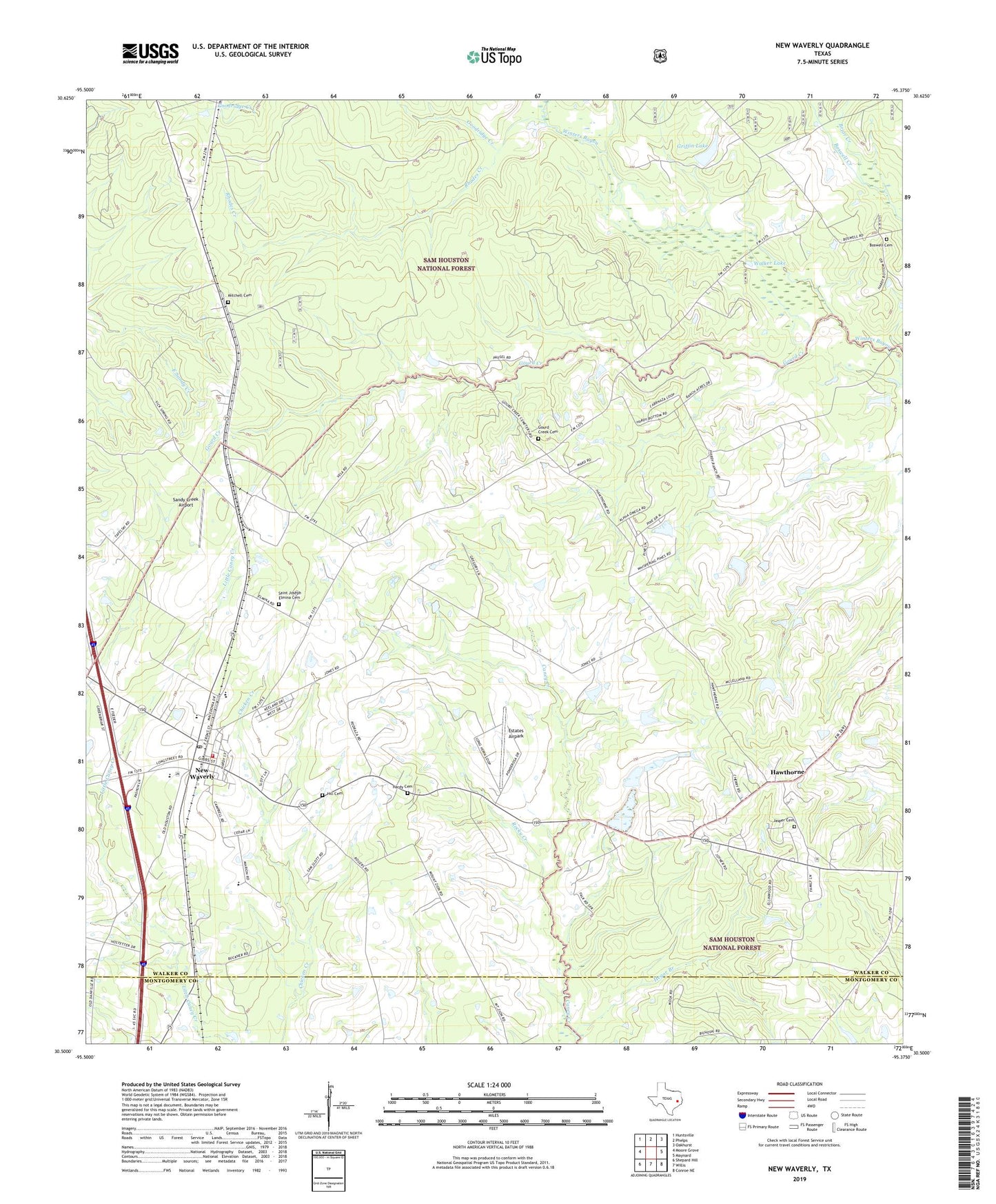
2022 topographic map quadrangle New Waverly in the state of Texas. Scale: 1:24000. Based on the newly updated USGS 7.5' US Topo map series, this map is in the following counties: Walker, Montgomery. The map contains contour data, water features, and other items you are used to seeing on USGS maps, but also has updated roads and other features. This is the next generation of topographic maps. Printed on high-quality waterproof paper with UV fade-resistant inks.
Quads adjacent to this one:
West: Moore Grove
Northwest: Huntsville
North: Phelps
Northeast: Oakhurst
East: Maynard
Southeast: Conroe NE
South: Willis
Southwest: Shepard Hill
This map covers the same area as the classic USGS quad with code o30095e4.
Contains the following named places: Barado, Boswell Cemetery, Boswell Church, Briar Creek, City of New Waverly, Elmina, Estates Airpark, Goodridge Creek, Gourd Creek, Gourd Creek Cemetery, Griffin Lake, Griffin Lake Dam, Hardy Cemetery, Hawthorne, Hegar Branch, Hill Cemetery, Jasper Cemetery, Mitchell Cemetery, New Waverly, New Waverly City Hall, New Waverly Division, New Waverly Post Office, New Waverly Volunteer Fire Department, Newlight Church, Rhodes Creek, Rocky Creek, Saint Joseph Elmina Cemetery, Sandy Creek Airport, Unity Church, Walker County Constable's Office Precinct 4, Walker Lake, ZIP Code: 77358