MyTopo
Spur NW Texas US Topo Map
Couldn't load pickup availability
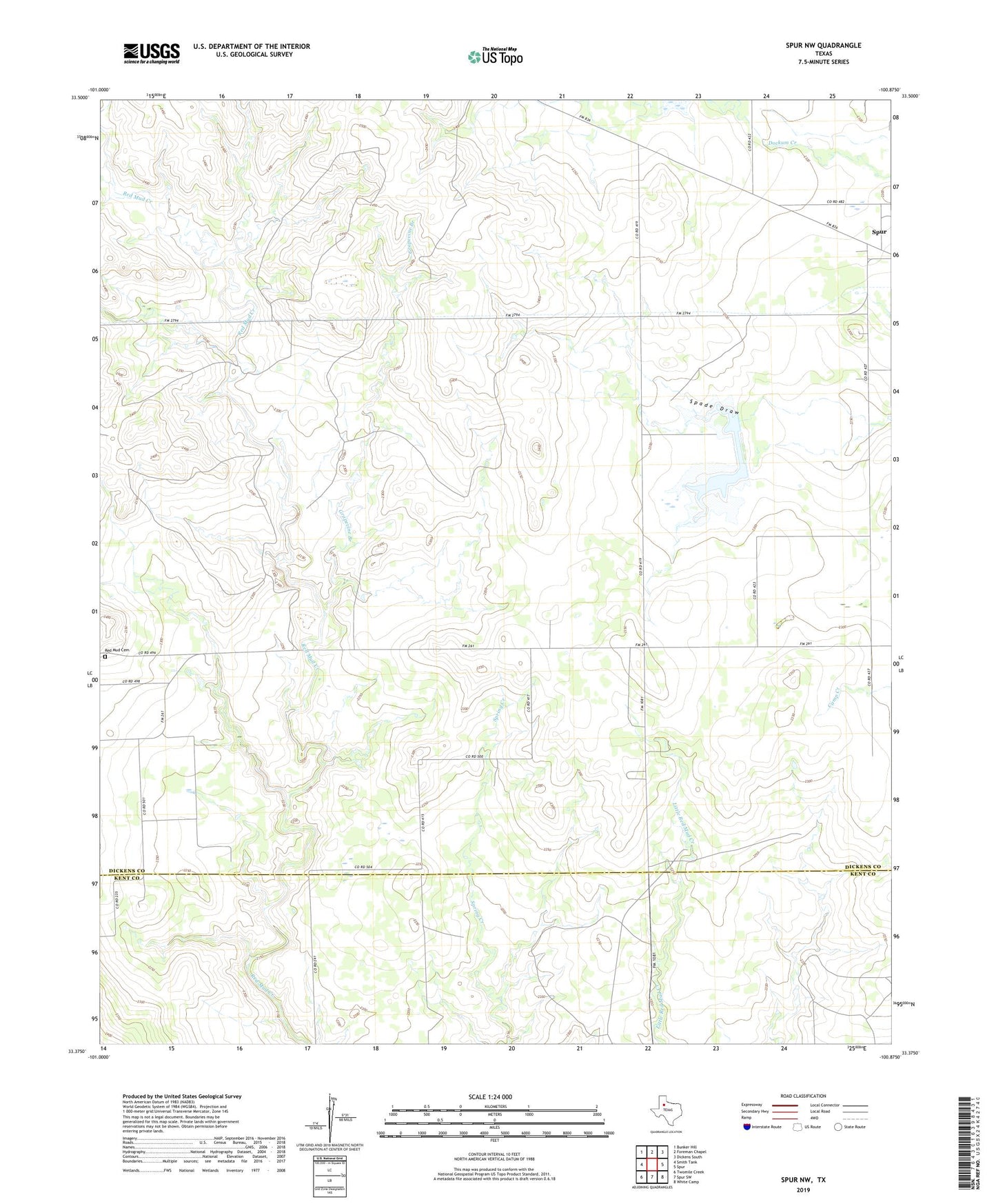
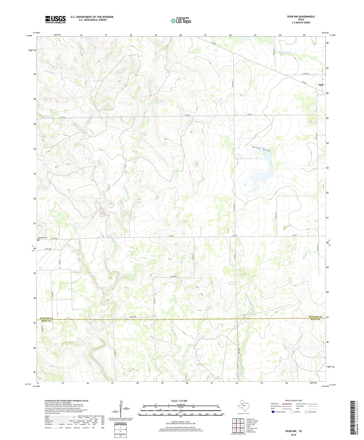
2019 topographic map quadrangle Spur NW in the state of Texas. Scale: 1:24000. Based on the newly updated USGS 7.5' US Topo map series, this map is in the following counties: Dickens, Kent. The map contains contour data, water features, and other items you are used to seeing on USGS maps, but also has updated roads and other features. This is the next generation of topographic maps. Printed on high-quality waterproof paper with UV fade-resistant inks.
Quads adjacent to this one:
West: Smith Tank
Northwest: Bunker Hill
North: Foreman Chapel
Northeast: Dickens South
East: Spur
Southeast: White Camp
South: Spur SW
Southwest: Twomile Creek
Contains the following named places: Grapevine Branch, Red Mud, Red Mud Cemetery, Rolling Plains Research Station, Soil Conservation Service Site 11 Dam, Soil Conservation Service Site 11 Reservoir