MyTopo
Staley Texas US Topo Map
Couldn't load pickup availability
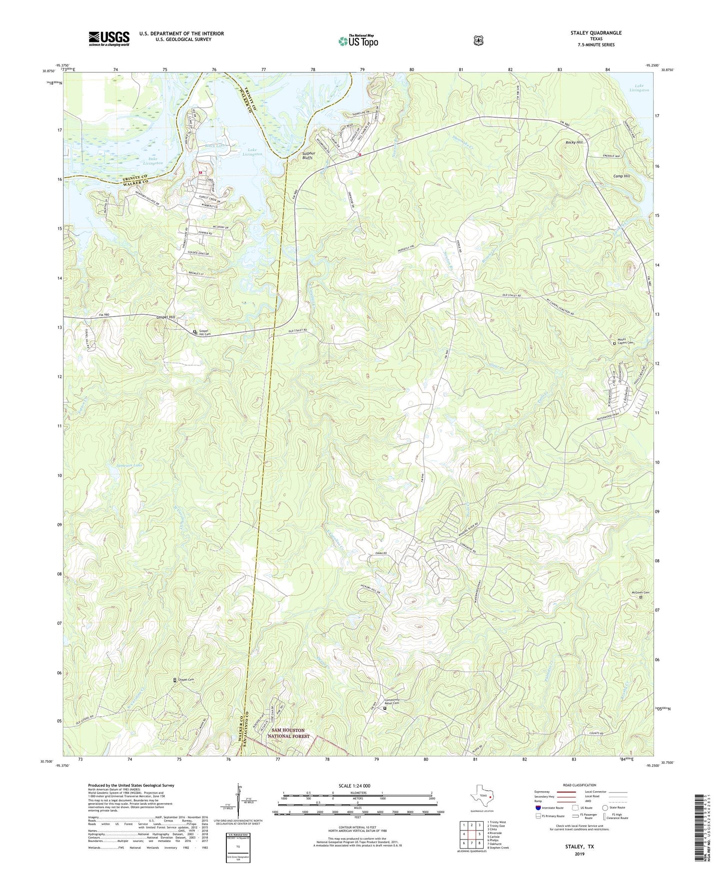
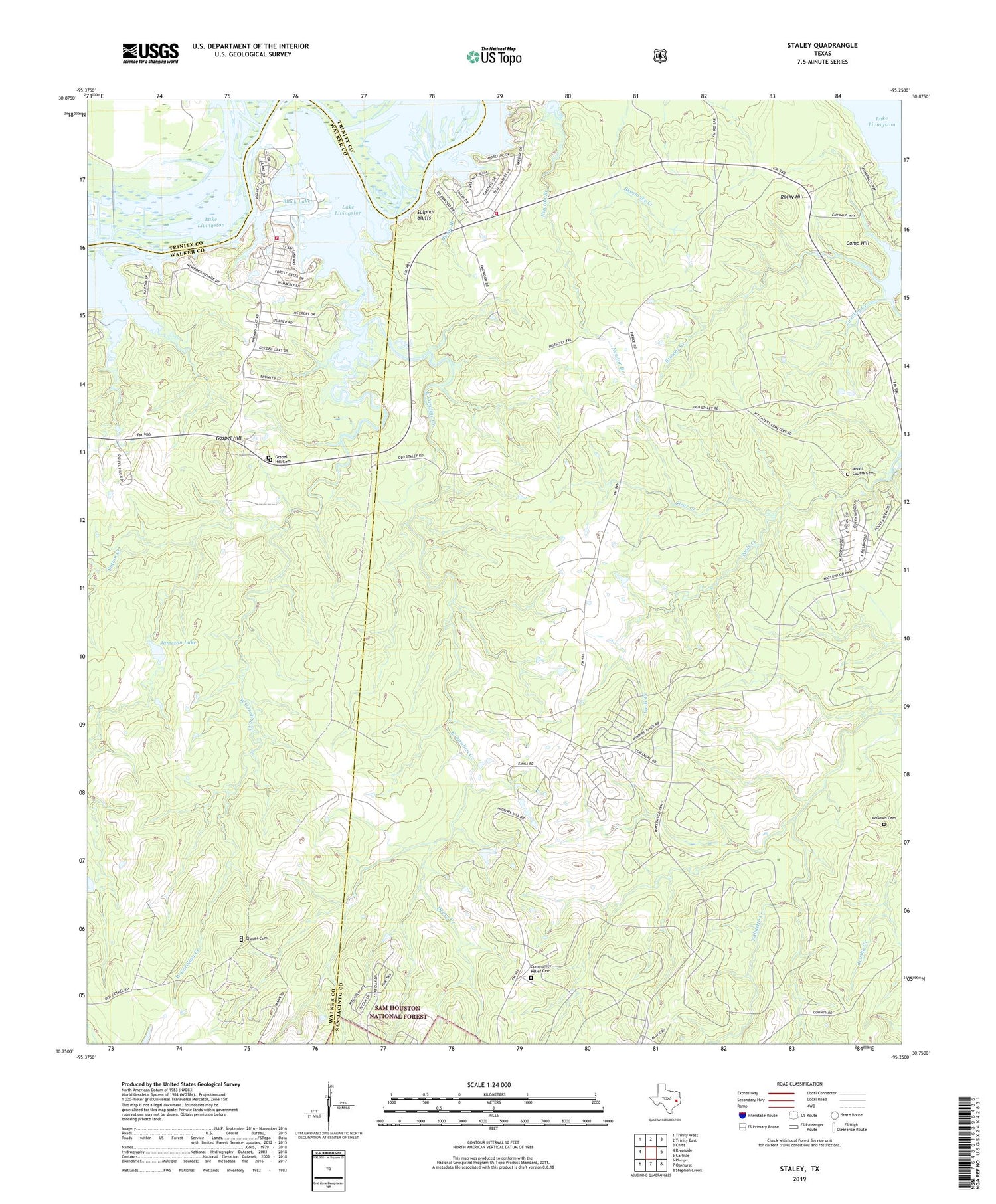
2019 topographic map quadrangle Staley in the state of Texas. Scale: 1:24000. Based on the newly updated USGS 7.5' US Topo map series, this map is in the following counties: San Jacinto, Walker, Trinity. The map contains contour data, water features, and other items you are used to seeing on USGS maps, but also has updated roads and other features. This is the next generation of topographic maps. Printed on high-quality waterproof paper with UV fade-resistant inks.
Quads adjacent to this one:
West: Riverside
Northwest: Trinity West
North: Trinity East
Northeast: Chita
East: Carlisle
Southeast: Stephen Creek
South: Oakhurst
Southwest: Phelps
Contains the following named places: 980 North Volunteer Fire Department, Belle and Ford Lake, Bethea Creek, Black Lake, Browns Creek, Burge Branch, Camp Hill, Carolina Creek, Chapel Cemetery, Clear Creek, Community Relief Cemetery, Deans Creek, East Carolina Creek, Gospel Hill, Gospel Hill Cemetery, Gospel Hill School, Jameson Dam, Jameson Lake, McGowen Cemetery, Mount Capers Cemetery, Newton Branch, Palmetto Park, Pools Creek, Rocky Hill, Staley, Sulphur Bluffs, Sutton Creek, Thomas Lake, Thomas Lake Road Volunteer Fire Department, West Carolina Creek, Zwickey Creek, ZIP Codes: 77334, 77359