MyTopo
Talco Texas US Topo Map
Couldn't load pickup availability
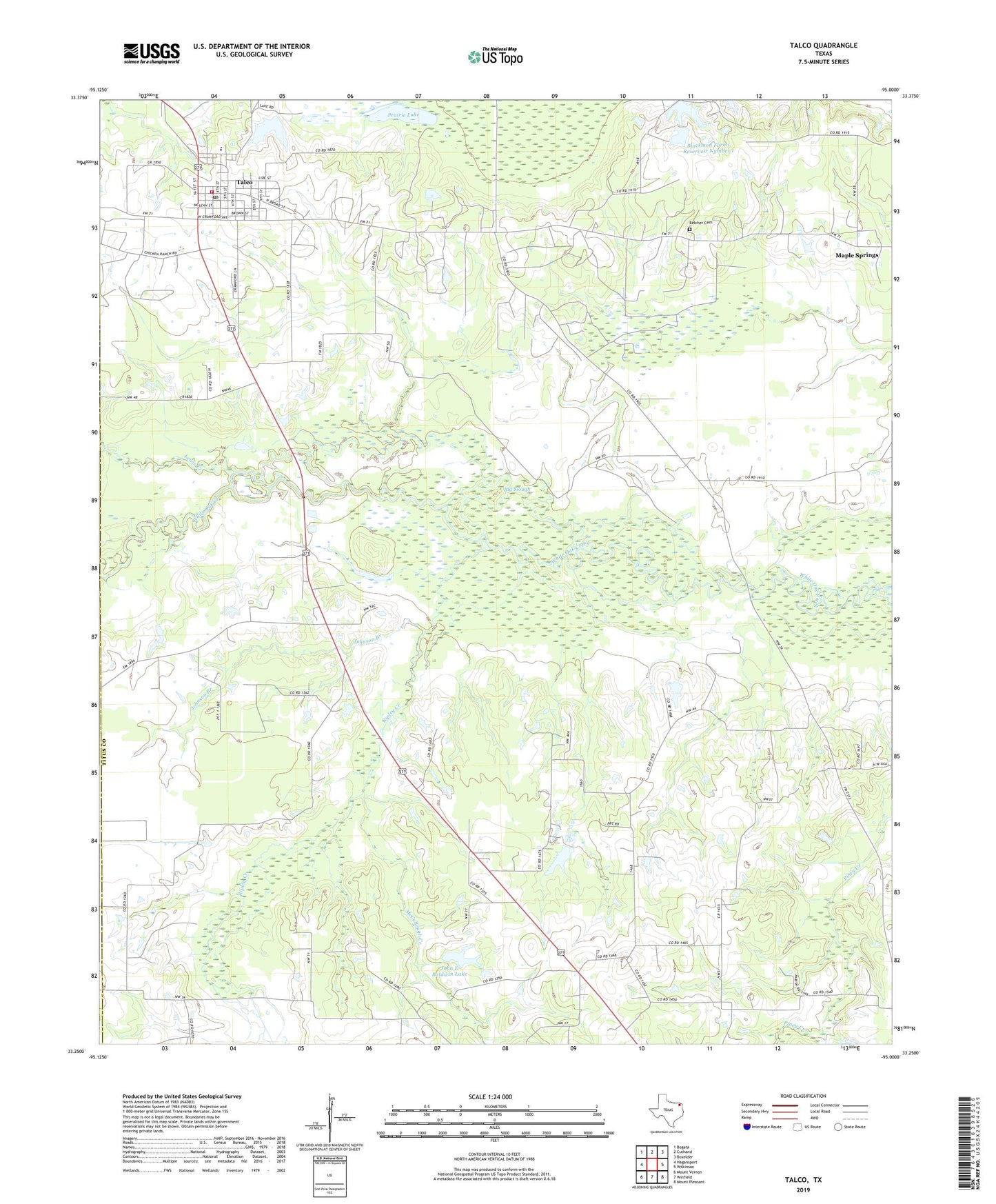
2019 topographic map quadrangle Talco in the state of Texas. Scale: 1:24000. Based on the newly updated USGS 7.5' US Topo map series, this map is in the following counties: Titus, Franklin. The map contains contour data, water features, and other items you are used to seeing on USGS maps, but also has updated roads and other features. This is the next generation of topographic maps. Printed on high-quality waterproof paper with UV fade-resistant inks.
Quads adjacent to this one:
West: Hagansport
Northwest: Bogata
North: Cuthand
Northeast: Boxelder
East: Wilkinson
Southeast: Mount Pleasant
South: Winfield
Southwest: Mount Vernon
Contains the following named places: Belcher Cemetery, Big Slough, Blackmon Farms Reservoir Number 1, Blackmon Farms Reservoir Number 1 Dam, Blackmon Farms Reservoir Number 2, Blackmon Farms Reservoir Number 2 Dam, Bridges Chapel, City of Talco, John E Baldwin Dam, John E Baldwin Lake, Johnson Branch, Lewis Creek, Maple Springs, McCullough Creek, Prairie Lake, Ripley Creek, Talco, Talco City Hall, Talco Oil Field, Talco Post Office, Talco Rodeo Ground, Talco Volunteer Fire Department, White Oak