MyTopo
Wilkinson Texas US Topo Map
Couldn't load pickup availability
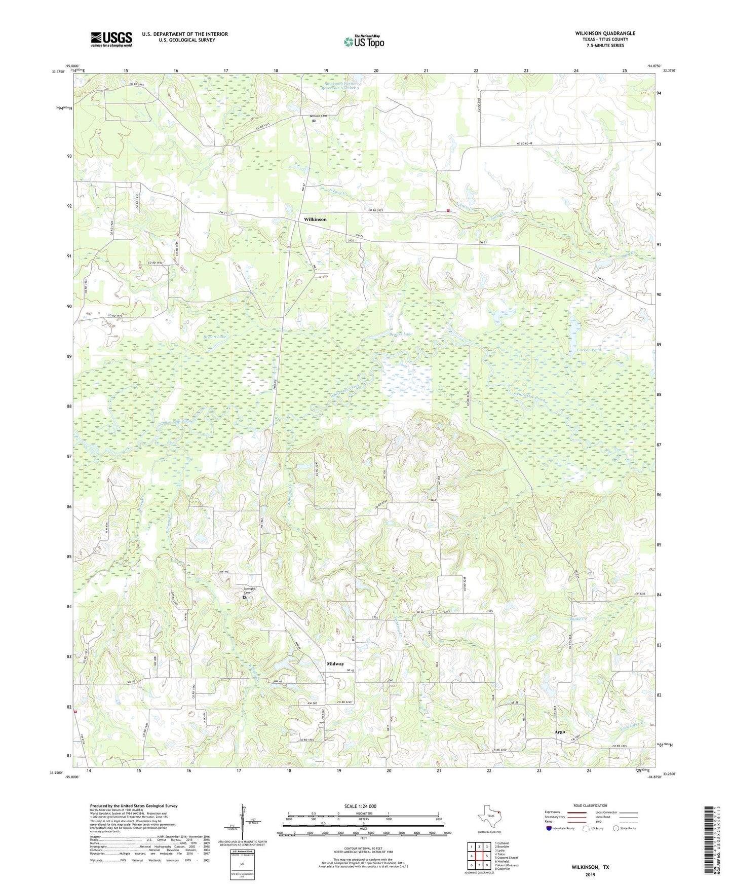
2022 topographic map quadrangle Wilkinson in the state of Texas. Scale: 1:24000. Based on the newly updated USGS 7.5' US Topo map series, this map is in the following counties: Titus. The map contains contour data, water features, and other items you are used to seeing on USGS maps, but also has updated roads and other features. This is the next generation of topographic maps. Printed on high-quality waterproof paper with UV fade-resistant inks.
Quads adjacent to this one:
West: Talco
Northwest: Cuthand
North: Boxelder
Northeast: Lydia
East: Coopers Chapel
Southeast: Cookville
South: Mount Pleasant
Southwest: Winfield
This map covers the same area as the classic USGS quad with code o33094c8.
Contains the following named places: Argo, Blackmon Farms Reservoir Number 5, Brooks Lake, Brown Lake, Cuckoo Pond, Deshiell Cemetery, East Piney Creek, Five Star Volunteer Fire Department, Harris Church, Midway, Mount Sylvia Church, North Lacy Creek, Piney, Piney Creek, South Lacy Creek, Springhill Cemetery, Stinking Creek, Sugar Hill Volunteer Fire Department, Talco Division, Trix-Liz Oil Field, Wilkinson