MyTopo
Timber Creek Texas US Topo Map
Couldn't load pickup availability
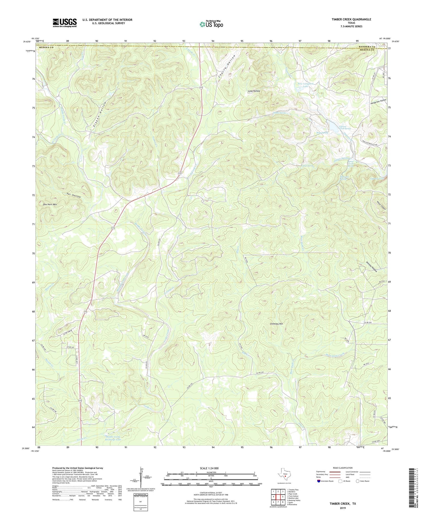
2019 topographic map quadrangle Timber Creek in the state of Texas. Scale: 1:24000. Based on the newly updated USGS 7.5' US Topo map series, this map is in the following counties: Medina, Bandera. The map contains contour data, water features, and other items you are used to seeing on USGS maps, but also has updated roads and other features. This is the next generation of topographic maps. Printed on high-quality waterproof paper with UV fade-resistant inks.
Quads adjacent to this one:
West: Twin Hollow
Northwest: Tarpley Pass
North: Bandera
Northeast: Pipe Creek
East: Medina Lake
Southeast: Riomedina
South: Quihi
Southwest: Mustang Valley
Contains the following named places: Cherry Hollow, Chimney Hill, Cow Creek, Cypress Creek, Cypress Creek Spring, East Verde Creek, Indian Spring, Indian Spring Creek, Long Hollow, Middle Spring, Middle Verde Creek, Middle Verde Recharge Dam, Middle Verde Recharge Lake, Moccasin Spring, New Langford Lake, New Langford Lake Dam, One Horn Mountain, Pecan Grove Spring, Pigpen Hollow, Sheep Spring, Smith Creek, Timber Creek, Vat Hollow, West Verde Creek