MyTopo
Tarpley Pass Texas US Topo Map
Couldn't load pickup availability
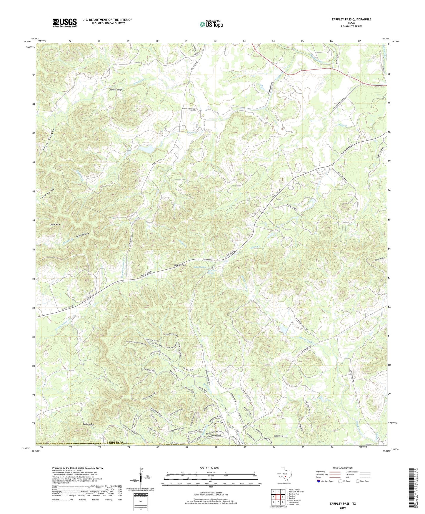
2022 topographic map quadrangle Tarpley Pass in the state of Texas. Scale: 1:24000. Based on the newly updated USGS 7.5' US Topo map series, this map is in the following counties: Bandera, Medina. The map contains contour data, water features, and other items you are used to seeing on USGS maps, but also has updated roads and other features. This is the next generation of topographic maps. Printed on high-quality waterproof paper with UV fade-resistant inks.
Quads adjacent to this one:
West: Tarpley
Northwest: A Bar A Ranch
North: Rock Cliff Reservoir
Northeast: Bandera Pass
East: Bandera
Southeast: Timber Creek
South: Twin Hollow
Southwest: Texas Mountain
This map covers the same area as the classic USGS quad with code o29099f2.
Contains the following named places: Amasa Clark Cemetery, Bandera County, Barnes Gap, Cedar Hollow, Chalk Mountain, El Paraiso Ranch, Elam Canyon, Hicks Creek, Hill Country State Natural Area, Hill Country State Natural Area Trail, Indian Spring, Lovers Leap, Middle Verde Ranch Lake, Middle Verde Ranch Lake Dam, Pear Tree Spring, Pugmore Creek, Tarpley Pass, Winans Creek, Wolf Creek