MyTopo
Troup East Texas US Topo Map
Couldn't load pickup availability
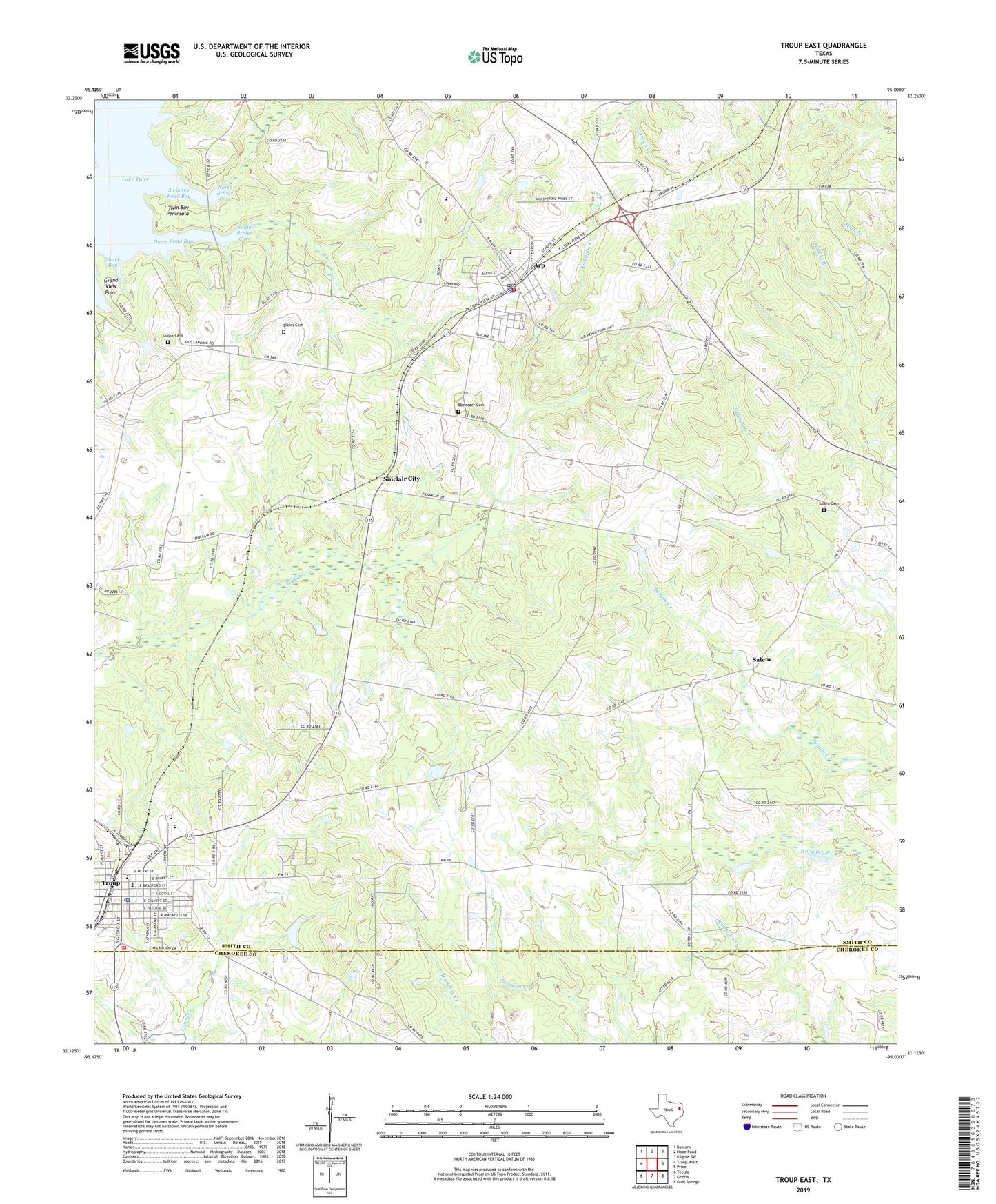
2022 topographic map quadrangle Troup East in the state of Texas. Scale: 1:24000. Based on the newly updated USGS 7.5' US Topo map series, this map is in the following counties: Smith, Cherokee. The map contains contour data, water features, and other items you are used to seeing on USGS maps, but also has updated roads and other features. This is the next generation of topographic maps. Printed on high-quality waterproof paper with UV fade-resistant inks.
Quads adjacent to this one:
West: Troup West
Northwest: Bascom
North: Hope Pond
Northeast: Kilgore SW
East: Price
Southeast: Gum Springs
South: Griffin
Southwest: Tecula
This map covers the same area as the classic USGS quad with code o32095b1.
Contains the following named places: Arp, Arp City Hall, Arp High School, Arp Junior High School, Arp Police Department, Arp Post Office, Arp Volunteer Fire Department, City of Arp, City of Troup, Ebenezer Cemetery, Elkins Cemetery, First Presbyterian Church, Good Omen Oil Field, Grace Temple Church, Grand View Point, Hilltop Country Club, Liberty Church, Mary Memorial Church of God Christ, Mason Cemetery, Mason Church, Mount Herman Church, Mount Rose Baptist Church, New Hope Church, North Bridge Cove, Omen, Omen Road Bay, Salem, Salem Cemetery, Salem Church, Shark Bay, Shiloh Cemetery, Sinclair Church, Sinclair Church of Christ, Sinclair City, Smith County Constable's Office Precinct 3, South Bridge Cove, Spring Chapel, Summer Hill Select School, Swan Bay, Swinney Road Bay, Troup, Troup City Cemetery, Troup City Hall, Troup Elementary School, Troup High School, Troup Middle School, Troup Police Department, Troup Post Office, Troup Volunteer Fire Department Central Station, Troup-Arp Division, Twin Bay Peninsula, Union Grove Church