MyTopo
Turtle Hole Camp Texas US Topo Map
Couldn't load pickup availability
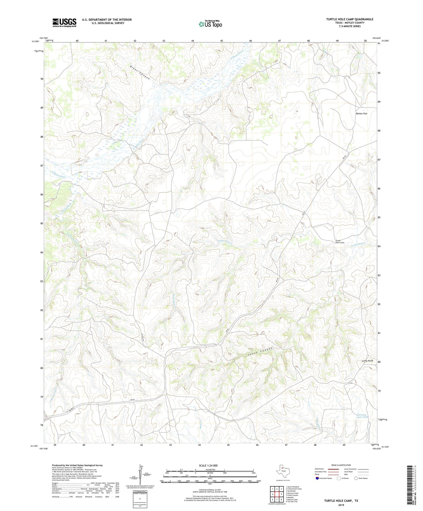
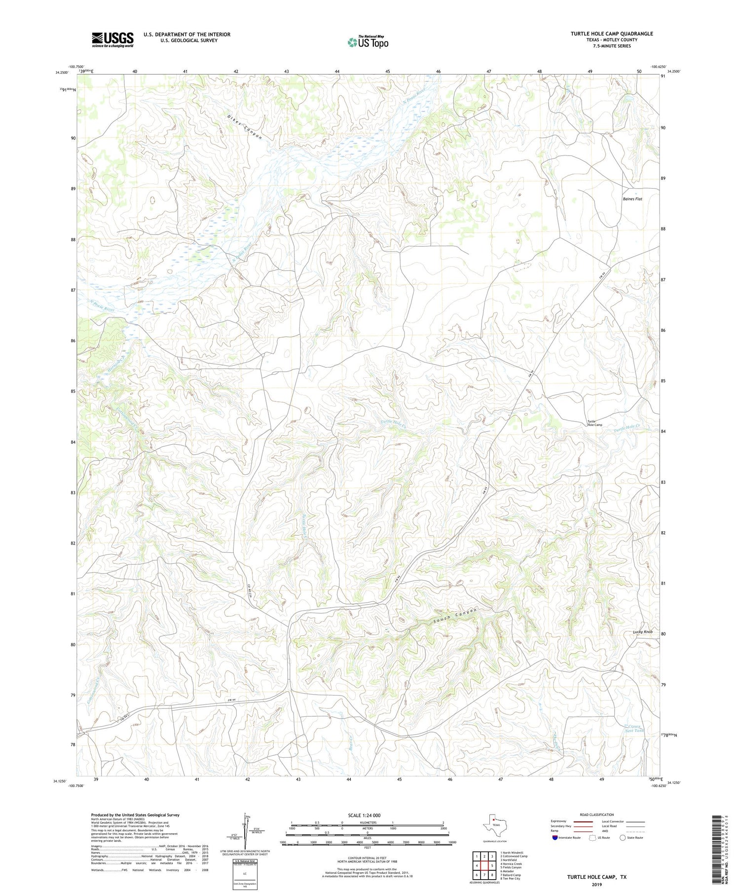
2019 topographic map quadrangle Turtle Hole Camp in the state of Texas. Scale: 1:24000. Based on the newly updated USGS 7.5' US Topo map series, this map is in the following counties: Motley. The map contains contour data, water features, and other items you are used to seeing on USGS maps, but also has updated roads and other features. This is the next generation of topographic maps. Printed on high-quality waterproof paper with UV fade-resistant inks.
Quads adjacent to this one:
West: Hornica Creek
Northwest: North Windmill
North: Cottonwood Camp
Northeast: Northfield
East: Fields Canyon
Southeast: Tee Pee City
South: Ballard Camp
Southwest: Matador
Contains the following named places: Baines Flat, Berryman Windmill, Cottonwood Creek, Crows Nest Tank, Dikes Canyon, Hornica Creek, Lucky Knob, Lucky Knob Camp, Oil Well Windmill, Red Windmill, South Canyon, The Ditch Windmill, Tom Ball Creek, Turtle Hole Camp