MyTopo
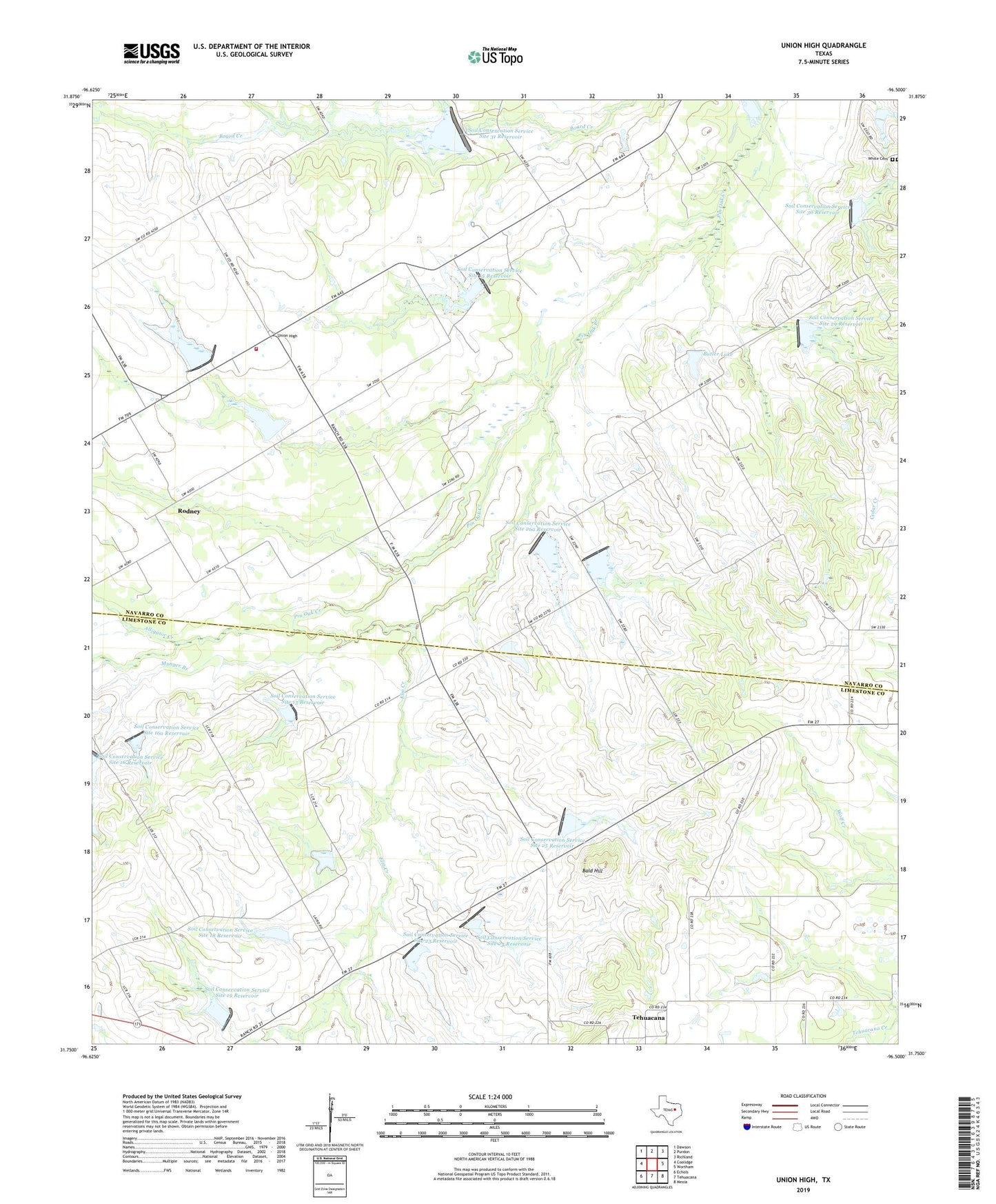
Union High Texas US Topo Map
Couldn't load pickup availability
2022 topographic map quadrangle Union High in the state of Texas. Scale: 1:24000. Based on the newly updated USGS 7.5' US Topo map series, this map is in the following counties: Navarro, Limestone. The map contains contour data, water features, and other items you are used to seeing on USGS maps, but also has updated roads and other features. This is the next generation of topographic maps. Printed on high-quality waterproof paper with UV fade-resistant inks.
Quads adjacent to this one:
West: Coolidge
Northwest: Dawson
North: Purdon
Northeast: Richland
East: Wortham
Southeast: Mexia
South: Tehuacana
Southwest: Echols
This map covers the same area as the classic USGS quad with code o31096g5.
Contains the following named places: Alligator Creek, Bald Hill, Butler Lake, Butler Lake Dam, Dam Number 13, Dam Number 14A, Dam Number 15, Dam Number 16, Dam Number 16A, Dam Number 17, Dam Number 18, Dam Number 19, Dam Number 23, Dam Number 24, Dam Number 25, Dam Number 26, Dam Number 26H, Dam Number 29, Dam Number 30, Dam Number 31, Denison Public Library, Elm Creek, Howe Community Library, Munger Branch, Rodney, Shady Grove Church, Sherman Public Library, Soil Conservation Service Site 13 Dam, Soil Conservation Service Site 13 Reservoir, Soil Conservation Service Site 14 Dam, Soil Conservation Service Site 14 Reservoir, Soil Conservation Service Site 14a Dam, Soil Conservation Service Site 14a Reservoir, Soil Conservation Service Site 15 Dam, Soil Conservation Service Site 15 Reservoir, Soil Conservation Service Site 16 Dam, Soil Conservation Service Site 16a Dam, Soil Conservation Service Site 16a Reservoir, Soil Conservation Service Site 17 Dam, Soil Conservation Service Site 17 Reservoir, Soil Conservation Service Site 18 Dam, Soil Conservation Service Site 18 Reservoir, Soil Conservation Service Site 19 Dam, Soil Conservation Service Site 19 Reservoir, Soil Conservation Service Site 23 Dam, Soil Conservation Service Site 23 Reservoir, Soil Conservation Service Site 24 Dam, Soil Conservation Service Site 24 Reservoir, Soil Conservation Service Site 25 Dam, Soil Conservation Service Site 25 Reservoir, Soil Conservation Service Site 26 Dam, Soil Conservation Service Site 26 Reservoir, Soil Conservation Service Site 26a Dam, Soil Conservation Service Site 26a Reservoir, Soil Conservation Service Site 29 Dam, Soil Conservation Service Site 29 Reservoir, Soil Conservation Service Site 30 Dam, Soil Conservation Service Site 30 Reservoir, Soil Conservation Service Site 31 Dam, Soil Conservation Service Site 31 Reservoir, Tehuacana Quarry, Union High, Union High Volunteer Fire Department, White Cemetery, ZIP Code: 76686