MyTopo
Alton Utah US Topo Map
Couldn't load pickup availability
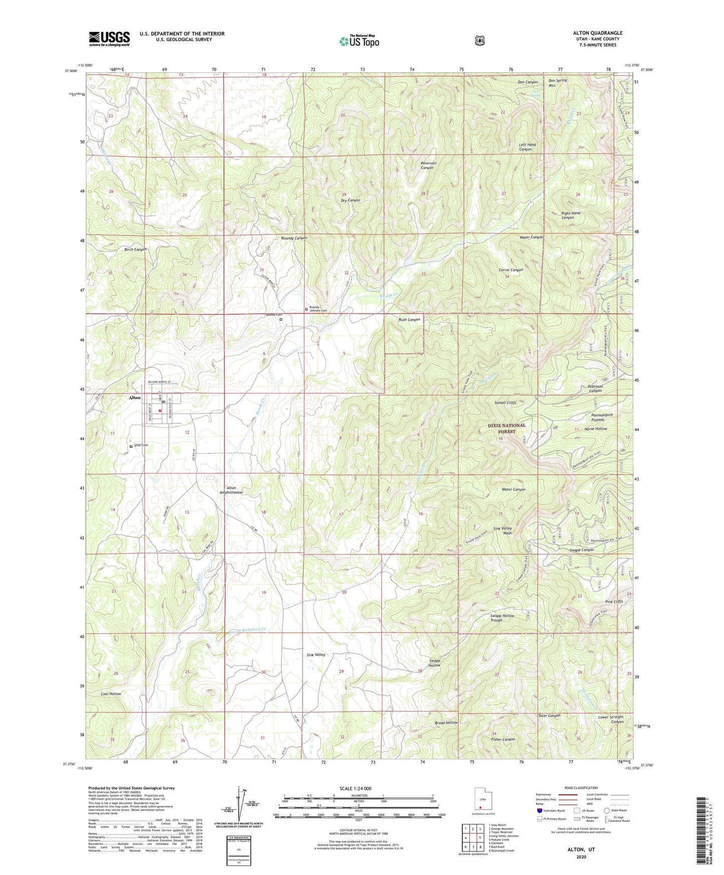
2020 topographic map quadrangle Alton in the state of Utah. Scale: 1:24000. Based on the newly updated USGS 7.5' US Topo map series, this map is in the following counties: Kane. The map contains contour data, water features, and other items you are used to seeing on USGS maps, but also has updated roads and other features. This is the next generation of topographic maps. Printed on high-quality waterproof paper with UV fade-resistant inks.
Quads adjacent to this one:
West: Long Valley Junction
Northwest: Asay Bench
North: George Mountain
Northeast: Tropic Reservoir
East: Podunk Creek
Southeast: Skutumpah Creek
South: Bald Knoll
Southwest: Glendale
Contains the following named places: Alton, Alton Amphitheater, Alton Cemetery, Alton Fire Department, Alton Post Office, Birch Canyon, Coal Hollow, Corral Canyon, Don Spring, Dry Canyon, Dry Fork, Kane County Ambulance - Alton, Left Hand Canyon, Lower Robinson Creek, Lower Straight Canyon, Paunsaugunt Plateau, Reservoir Canyon, Right Hand Canyon, Roundy / Johnson Cemetery, Roundy Canyon, Roundy Cemetery, Rush Canyon, Sink Valley, Swapp Hollow, Swapp Ranch, The Church of Jesus Christ of Latter Day Saints, Water Canyon, ZIP Code: 84710