MyTopo
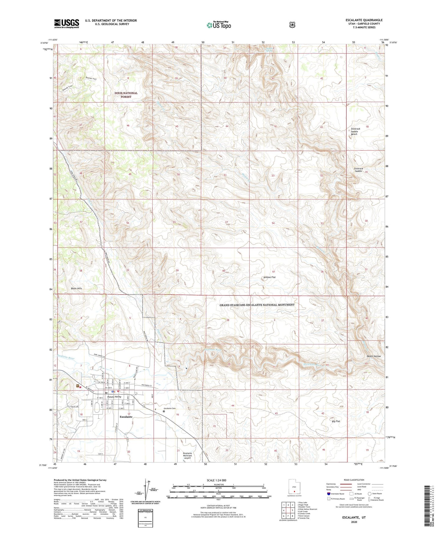
Escalante Utah US Topo Map
Couldn't load pickup availability
Also explore the Escalante Forest Service Topo of this same quad for updated USFS data
2023 topographic map quadrangle Escalante in the state of Utah. Scale: 1:24000. Based on the newly updated USGS 7.5' US Topo map series, this map is in the following counties: Garfield. The map contains contour data, water features, and other items you are used to seeing on USGS maps, but also has updated roads and other features. This is the next generation of topographic maps. Printed on high-quality waterproof paper with UV fade-resistant inks.
Quads adjacent to this one:
West: Wide Hollow Reservoir
Northwest: Posy Lake
North: Roger Peak
Northeast: Boulder Town
East: Calf Creek
Southeast: Tenmile Flat
South: Dave Canyon
Southwest: Canaan Creek
This map covers the same area as the classic USGS quad with code o37111g5.
Contains the following named places: Antone Flat, Big Flat, Boulder Mail Trail, City of Escalante, Death Hollow, Escalante, Escalante Cemetery, Escalante District Ranger Station, Escalante Elementary School, Escalante High School, Escalante Police Department, Escalante Post Office, Escalante Volunteer Fire Department, First Baptist Church, Garfield County Ambulance, Hole-in-the-Rock Road, Mamie Creek, Mogui Motel Campground, Phipps-Death Hollow Outstanding Natural Area, Pine Creek, Potato Valley, Slickrock Saddle, Slickrock Saddle Bench, Sulphur Spring, The Church of Jesus Christ of Latter Day Saints, United States Forest Service Fire Station - Escalante Office