MyTopo
Calf Creek Utah US Topo Map
Couldn't load pickup availability
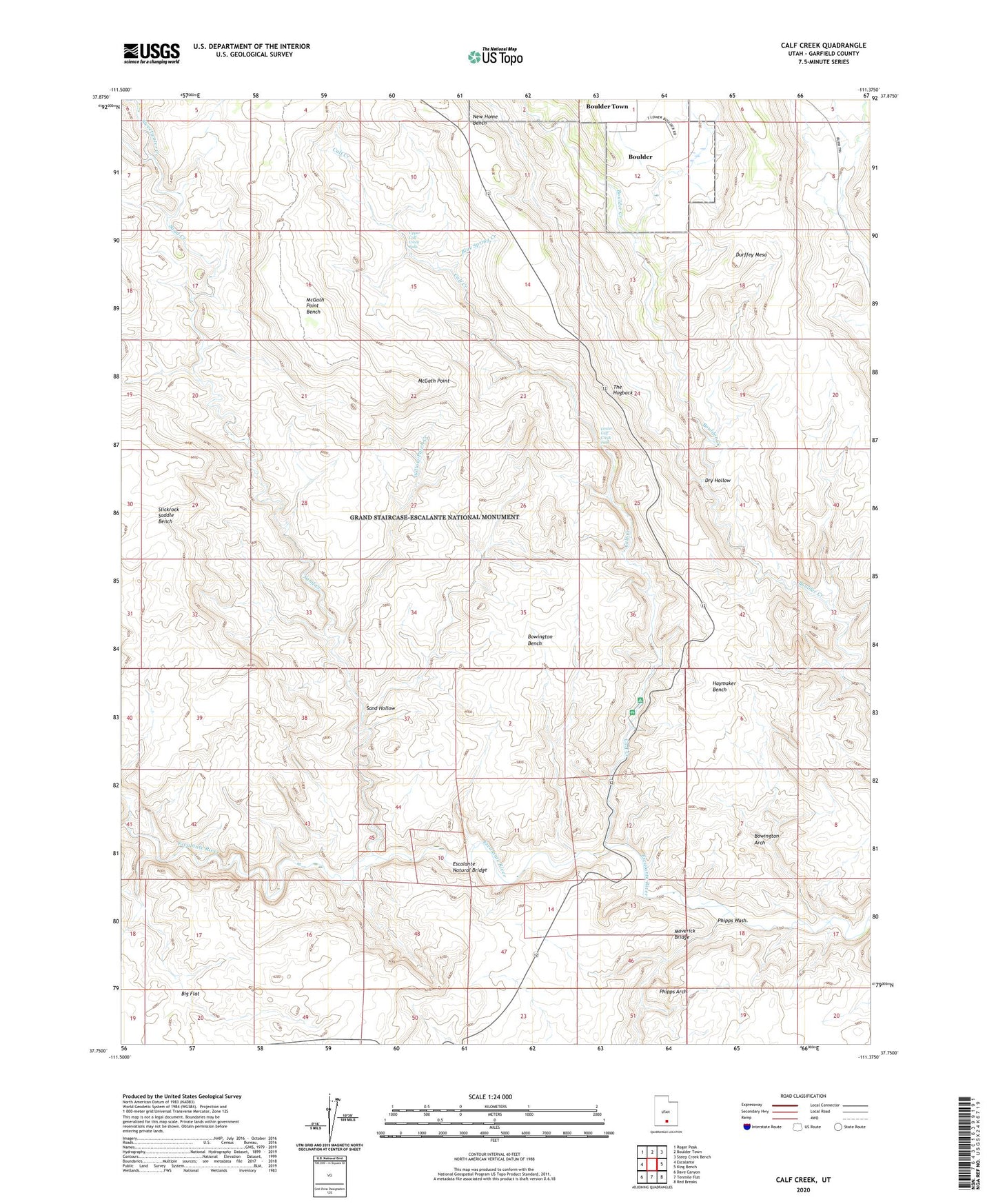
2023 topographic map quadrangle Calf Creek in the state of Utah. Scale: 1:24000. Based on the newly updated USGS 7.5' US Topo map series, this map is in the following counties: Garfield. The map contains contour data, water features, and other items you are used to seeing on USGS maps, but also has updated roads and other features. This is the next generation of topographic maps. Printed on high-quality waterproof paper with UV fade-resistant inks.
Quads adjacent to this one:
West: Escalante
Northwest: Roger Peak
North: Boulder Town
Northeast: Steep Creek Bench
East: King Bench
Southeast: Red Breaks
South: Tenmile Flat
Southwest: Dave Canyon
This map covers the same area as the classic USGS quad with code o37111g4.
Contains the following named places: Bowington Arch, Bowington Bench, Boynton Lookout, Calf Creek, Calf Creek Campground, Calf Creek Recreation Area, Dry Hollow, Durffey Mesa, Escalante Division, Escalante Natural Bridge, Garfield County, Haymaker Bench, Lower Calf Creek Falls, Maverick Bridge, McGath Point, McGath Point Bench, New Home Bench, Phipps Arch, Phipps Wash, Sand Creek, Sand Hollow, Sweetwater Creek, The Hogback, Upper Calf Creek Falls, Willow Patch Creek