MyTopo
Devil Mesa Utah US Topo Map
Couldn't load pickup availability
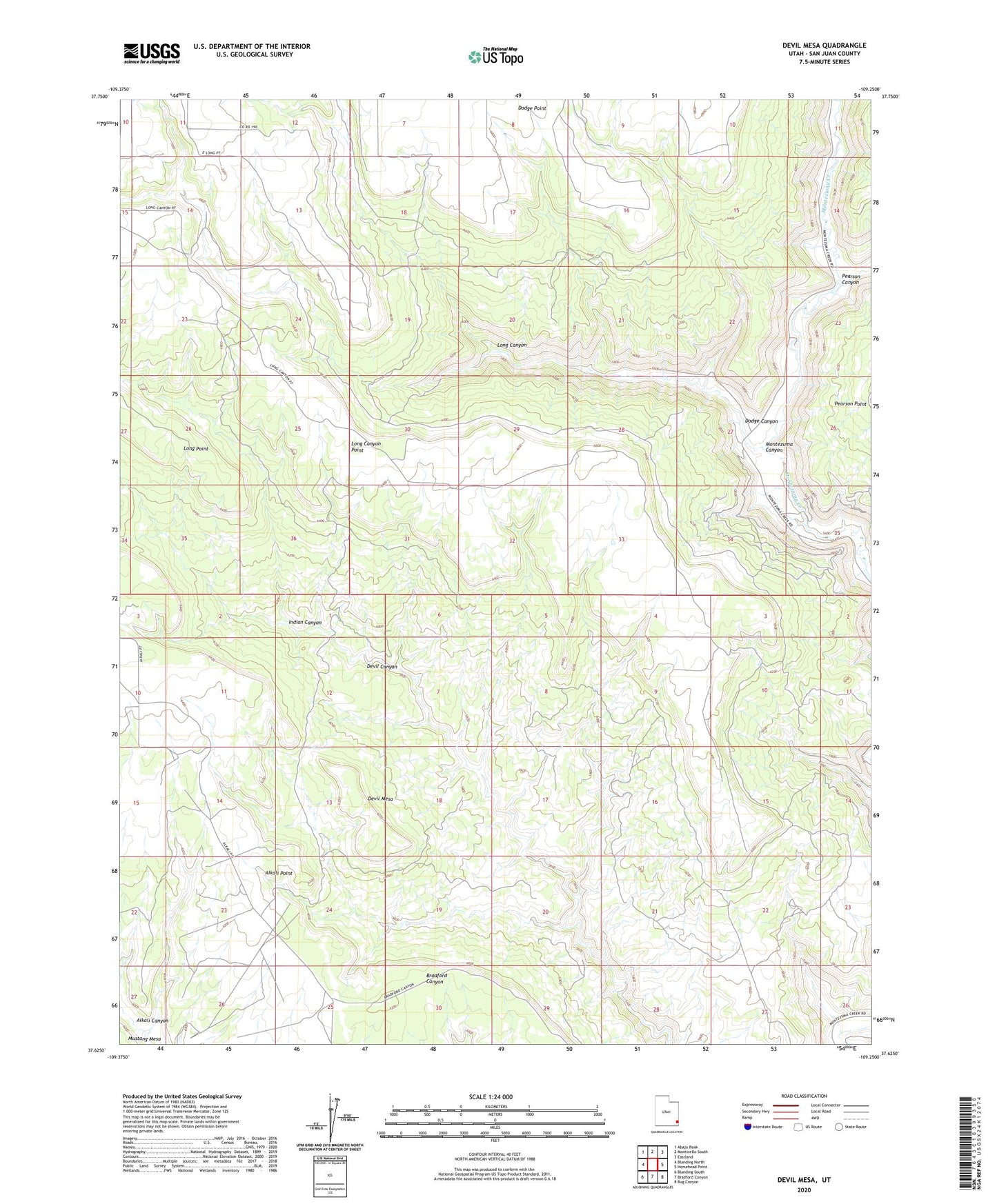
2023 topographic map quadrangle Devil Mesa in the state of Utah. Scale: 1:24000. Based on the newly updated USGS 7.5' US Topo map series, this map is in the following counties: San Juan. The map contains contour data, water features, and other items you are used to seeing on USGS maps, but also has updated roads and other features. This is the next generation of topographic maps. Printed on high-quality waterproof paper with UV fade-resistant inks.
Quads adjacent to this one:
West: Blanding North
Northwest: Abajo Peak
North: Monticello South
Northeast: Eastland
East: Horsehead Point
Southeast: Bug Canyon
South: Bradford Canyon
Southwest: Blanding South
This map covers the same area as the classic USGS quad with code o37109f3.
Contains the following named places: Devil Mesa, Dodge Canyon, Indian Canyon, Long Canyon, Pearson Canyon