MyTopo
Cutler Point Utah US Topo Map
Couldn't load pickup availability
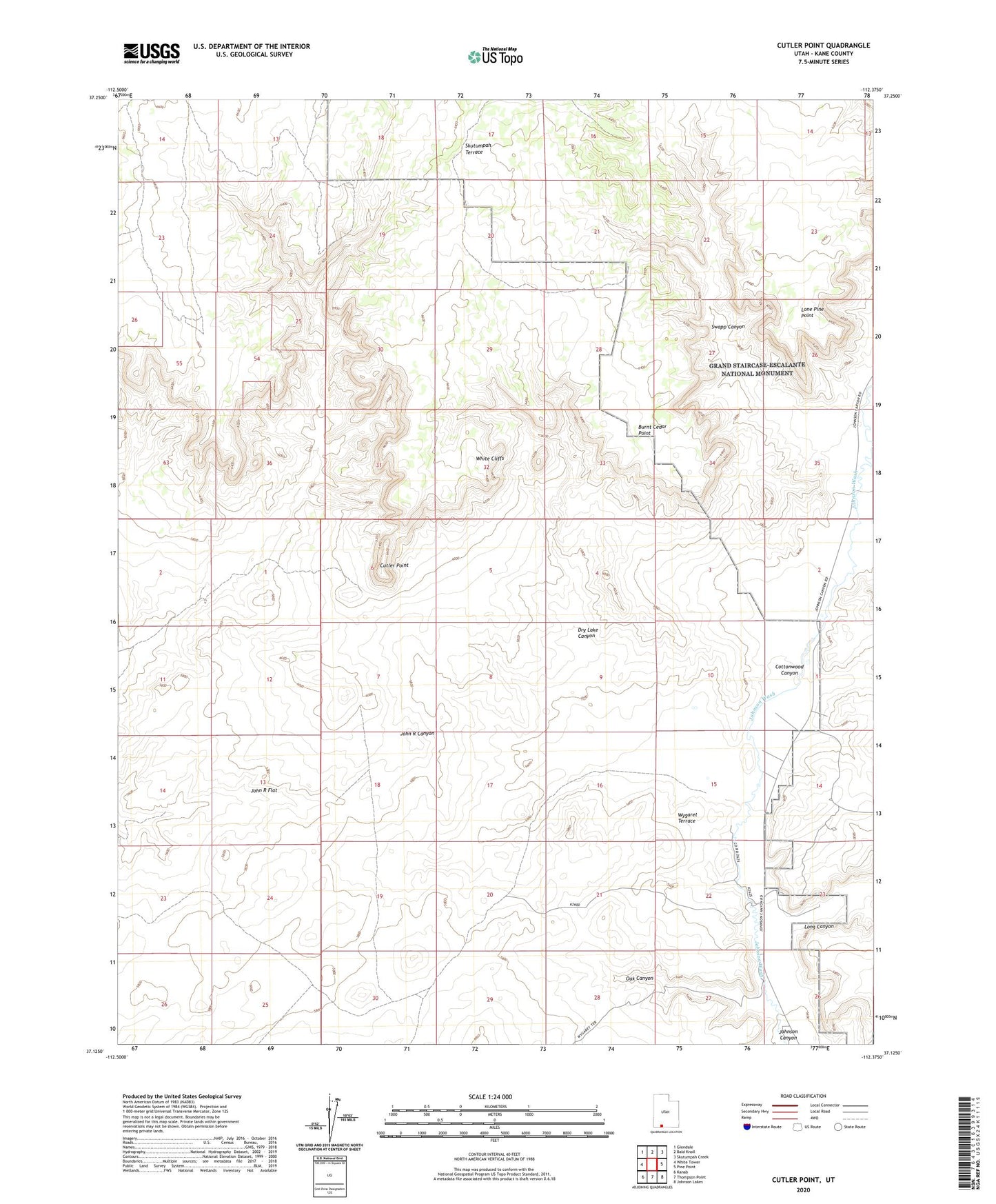
2020 topographic map quadrangle Cutler Point in the state of Utah. Scale: 1:24000. Based on the newly updated USGS 7.5' US Topo map series, this map is in the following counties: Kane. The map contains contour data, water features, and other items you are used to seeing on USGS maps, but also has updated roads and other features. This is the next generation of topographic maps. Printed on high-quality waterproof paper with UV fade-resistant inks.
Quads adjacent to this one:
West: White Tower
Northwest: Glendale
North: Bald Knoll
Northeast: Skutumpah Creek
East: Pine Point
Southeast: Johnson Lakes
South: Thompson Point
Southwest: Kanab
Contains the following named places: Bunting Ranch, Burnt Cedar Point, Cottonwood Canyon, Cutler Point, Dry Lake, Dry Lake Canyon, Granary Ranch, John R Flat, Lone Pine Point, Long Canyon, Oak Canyon, Skutumpah Terrace, Swapp Canyon, Windmill Pictographs, Wygaret Terrace