MyTopo
Hayes Canyon Utah US Topo Map
Couldn't load pickup availability
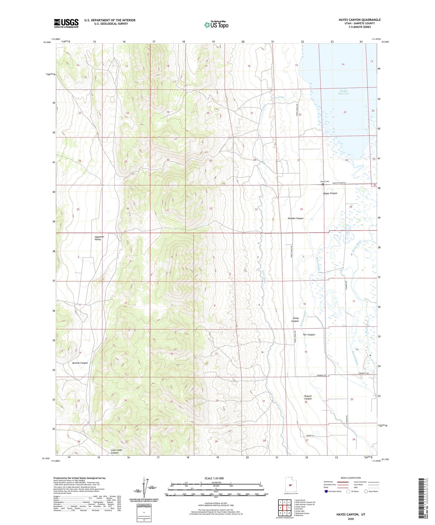
2020 topographic map quadrangle Hayes Canyon in the state of Utah. Scale: 1:24000. Based on the newly updated USGS 7.5' US Topo map series, this map is in the following counties: Sanpete. The map contains contour data, water features, and other items you are used to seeing on USGS maps, but also has updated roads and other features. This is the next generation of topographic maps. Printed on high-quality waterproof paper with UV fade-resistant inks.
Quads adjacent to this one:
West: Scipio South
Northwest: Scipio North
North: Hells Kitchen Canyon SW
Northeast: Hells Kitchen Canyon SE
East: Gunnison
Southeast: Redmond
South: Redmond Canyon
Southwest: Scipio Lake
Contains the following named places: Browse Canyon, Dover Canal, Dover Cemetery, Hayes Canyon, Japanese Valley, Metcalf Ditch, Pickett Canyon, San Pitch River, Sanpete Fish and Game Club, Steep Canyon, Swedes Canyon, Tarr Canyon