MyTopo
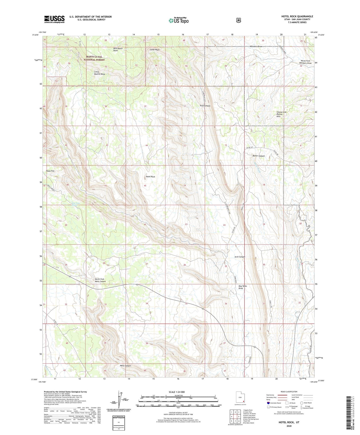
Hotel Rock Utah US Topo Map
Couldn't load pickup availability
Also explore the Hotel Rock Forest Service Topo of this same quad for updated USFS data
2023 topographic map quadrangle Hotel Rock in the state of Utah. Scale: 1:24000. Based on the newly updated USGS 7.5' US Topo map series, this map is in the following counties: San Juan. The map contains contour data, water features, and other items you are used to seeing on USGS maps, but also has updated roads and other features. This is the next generation of topographic maps. Printed on high-quality waterproof paper with UV fade-resistant inks.
Quads adjacent to this one:
West: South Long Point
Northwest: Kigalia Point
North: Cream Pots
Northeast: Mancos Jim Butte
East: Black Mesa Butte
Southeast: No-Mans Island
South: Bluff NW
Southwest: Snow Flat Spring Cave
This map covers the same area as the classic USGS quad with code o37109e6.
Contains the following named places: Arch Canyon, Arch Canyon Trail, Butler Wash Viewpoint, Dog Tanks Draw, Dog Tanks Spring, Hotel Rock, Little Baullie Mesa, North Fork Mule Canyon, North Fork Whiskers Draw, Perkins Ranch, Trail Canyon