MyTopo
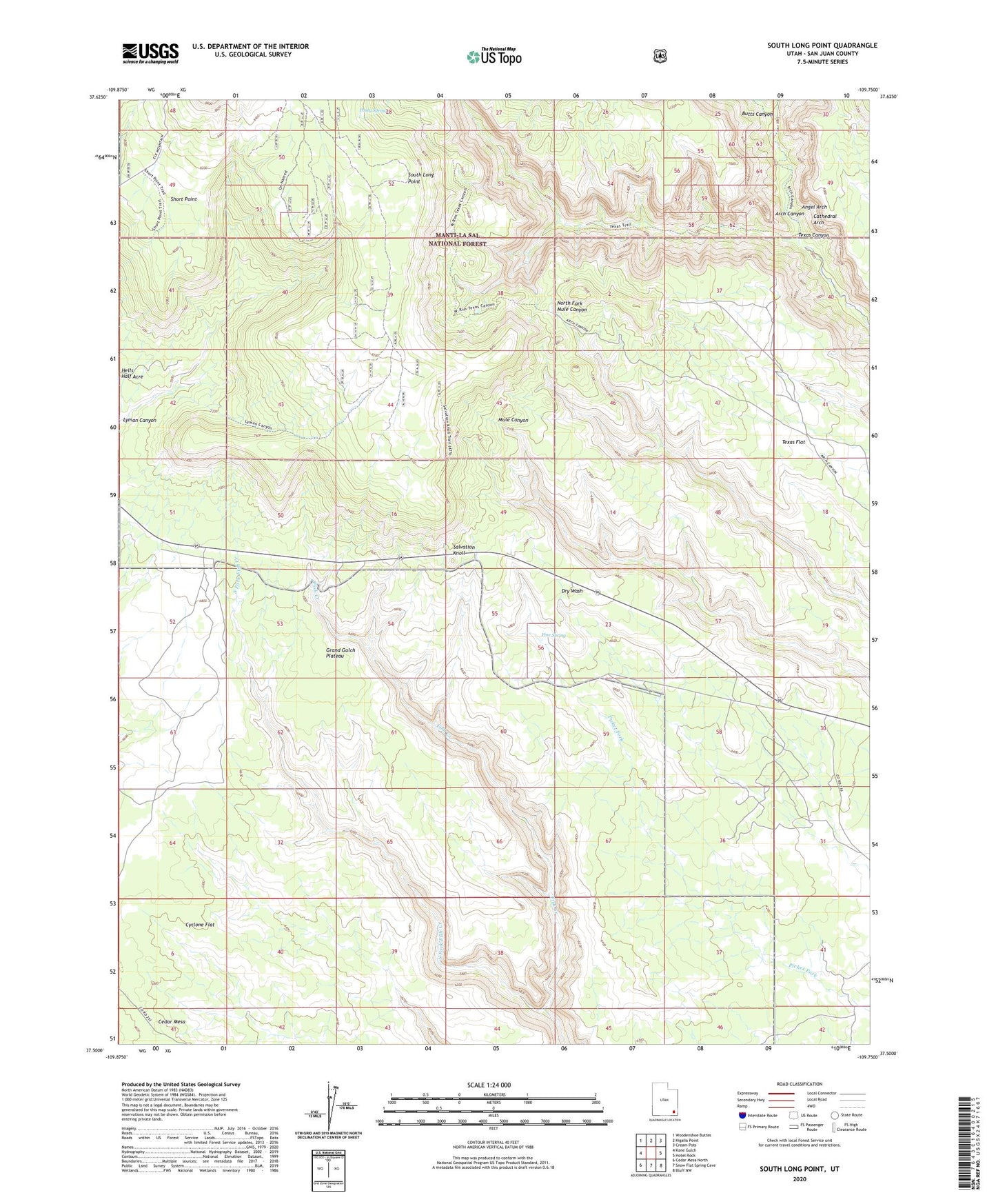
South Long Point Utah US Topo Map
Couldn't load pickup availability
Also explore the South Long Point Forest Service Topo of this same quad for updated USFS data
2023 topographic map quadrangle South Long Point in the state of Utah. Scale: 1:24000. Based on the newly updated USGS 7.5' US Topo map series, this map is in the following counties: San Juan. The map contains contour data, water features, and other items you are used to seeing on USGS maps, but also has updated roads and other features. This is the next generation of topographic maps. Printed on high-quality waterproof paper with UV fade-resistant inks.
Quads adjacent to this one:
West: Kane Gulch
Northwest: Woodenshoe Buttes
North: Kigalia Point
Northeast: Cream Pots
East: Hotel Rock
Southeast: Bluff NW
South: Snow Flat Spring Cave
Southwest: Cedar Mesa North
This map covers the same area as the classic USGS quad with code o37109e7.
Contains the following named places: Angel Arch, Arch Canyon Overlook, Baullies, Bears Ears National Monument, Butts Canyon, Cathedral Arch, Cave Towers, Cyclone Flat, Grand Gulch Plateau, Lyman Canyon, Pine Spring, Posey Spring, Salvation Knoll, Short Point, South Fork Fish Creek, South Long Point, Texas Canyon, Texas Flat