MyTopo
Jones Hole Utah US Topo Map
Couldn't load pickup availability
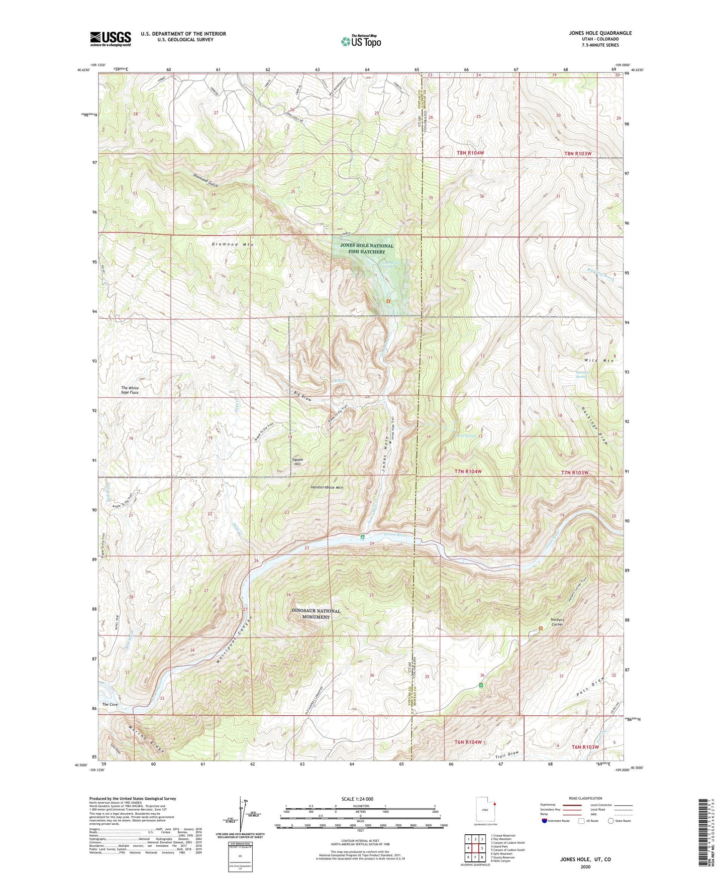
2023 topographic map quadrangle Jones Hole in the states of Utah, Colorado. Scale: 1:24000. Based on the newly updated USGS 7.5' US Topo map series, this map is in the following counties: Uintah, Moffat. The map contains contour data, water features, and other items you are used to seeing on USGS maps, but also has updated roads and other features. This is the next generation of topographic maps. Printed on high-quality waterproof paper with UV fade-resistant inks.
Quads adjacent to this one:
West: Island Park
Northwest: Crouse Reservoir
North: Hoy Mountain
Northeast: Canyon of Lodore North
East: Canyon of Lodore South
Southeast: Hells Canyon
South: Stuntz Reservoir
Southwest: Split Mountain
This map covers the same area as the classic USGS quad with code o40109e1.
Contains the following named places: Big Draw, Burnt Springs, Chew Ranch, Diamond Gulch, Ely Creek, Hackings Draw, Hackings Springs, Hardscrabble Mountain, Harpers Corner, Jones Hole, Jones Hole Creek, Jones Hole National Fish Hatchery, Jones Hole Ranger Station, Jones Hole Springs, Jones Hole Trail, Labyrinths, Martha Ridge, Red Wash, Sage Creek, Snow Ranch, Squaw Hill, The Cove, The White Sage Flats, Trail Draw, Whirlpool Canyon