MyTopo
Stuntz Reservoir Colorado US Topo Map
Couldn't load pickup availability
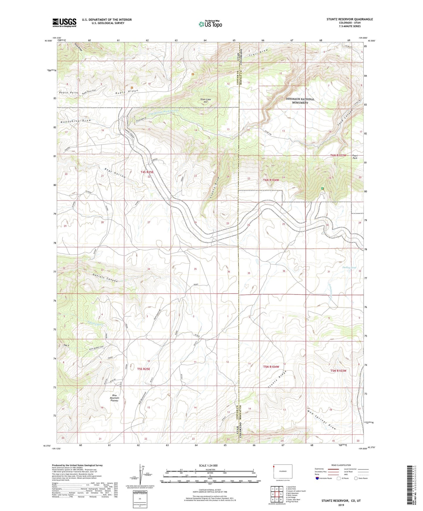
2022 topographic map quadrangle Stuntz Reservoir in the states of Utah, Colorado. Scale: 1:24000. Based on the newly updated USGS 7.5' US Topo map series, this map is in the following counties: Moffat, Uintah. The map contains contour data, water features, and other items you are used to seeing on USGS maps, but also has updated roads and other features. This is the next generation of topographic maps. Printed on high-quality waterproof paper with UV fade-resistant inks.
Quads adjacent to this one:
West: Split Mountain
Northwest: Island Park
North: Jones Hole
Northeast: Canyon of Lodore South
East: Hells Canyon
Southeast: Plug Hat Rock
South: Snake John Reef
Southwest: Cliff Ridge
Contains the following named places: Blue Mountain Indian Writings, Blue Mountain Plateau, Chew Ranch, Douglas Chew Cabin, Dudley Pond, Harland Cabin, Iron Springs Bench Overlook, Iron Springs Wash Pool Creek, Island Park Overlook, Ruple Point, Ruple Ridge, Snow Cabin, Snyder Seeps, Split Mountain Overlook, Stuntz Draw, Stuntz Reservoir, Stuntz Ridge, Susie Ridge, The V, Vivas Cake Hill, Wilkins Cabin