MyTopo
Fremont Pass Utah US Topo Map
Couldn't load pickup availability
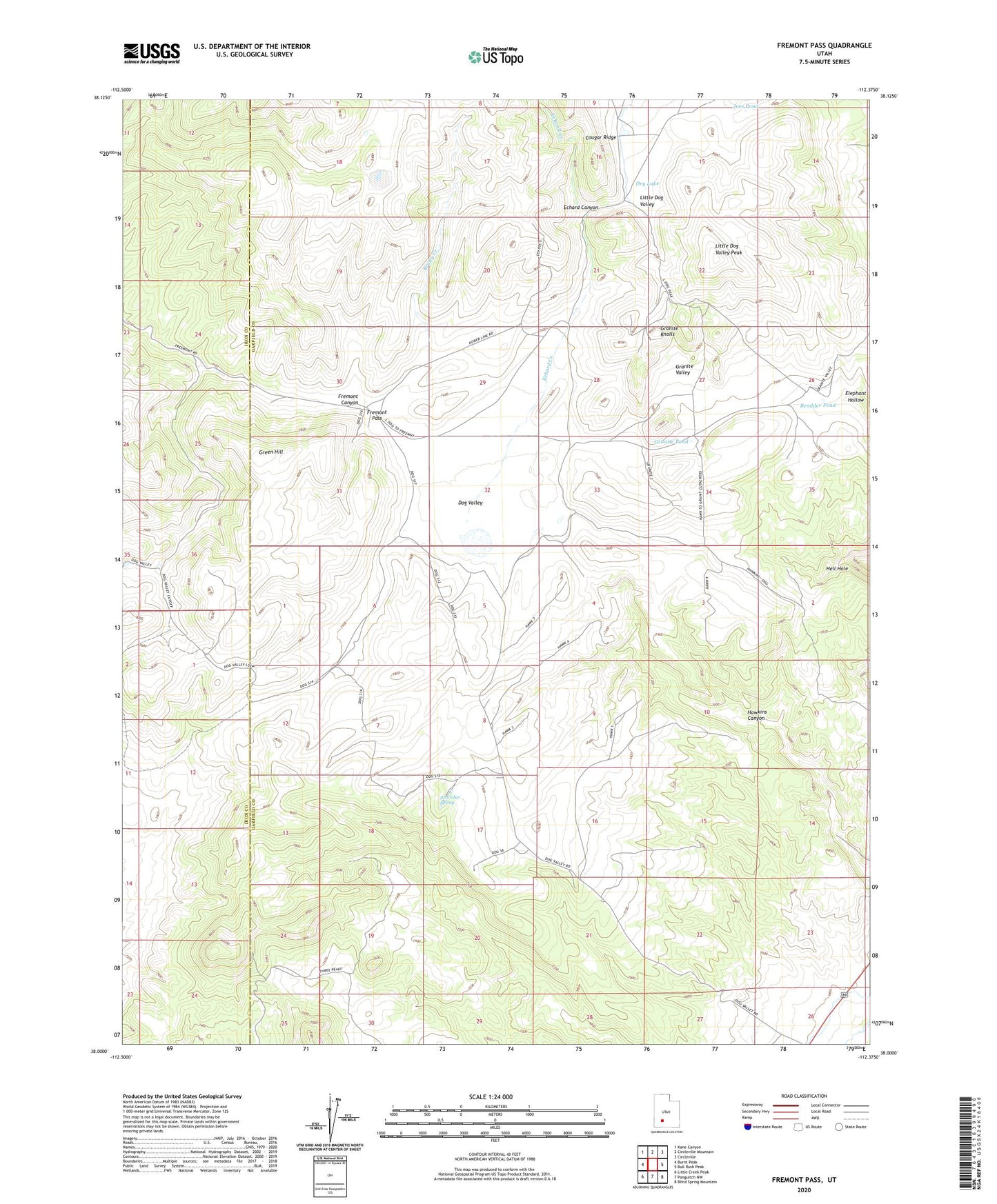
2023 topographic map quadrangle Fremont Pass in the state of Utah. Scale: 1:24000. Based on the newly updated USGS 7.5' US Topo map series, this map is in the following counties: Garfield, Iron. The map contains contour data, water features, and other items you are used to seeing on USGS maps, but also has updated roads and other features. This is the next generation of topographic maps. Printed on high-quality waterproof paper with UV fade-resistant inks.
Quads adjacent to this one:
West: Burnt Peak
Northwest: Kane Canyon
North: Circleville Mountain
Northeast: Circleville
East: Bull Rush Peak
Southeast: Blind Spring Mountain
South: Panguitch NW
Southwest: Little Creek Peak
This map covers the same area as the classic USGS quad with code o38112a4.
Contains the following named places: Bendder Pond, Brady Creek, Coyote Lake, Dog Valley, Dry Lake, Echard Canyon, Echard Creek, Elephant Hollow, Fremont Pass, Granite Knolls, Granite Pond, Granite Valley, Green Hill, Joes Pond, Little Dog Valley, Little Dog Valley Peak, Redcedar Spring