MyTopo
Circleville Mountain Utah US Topo Map
Couldn't load pickup availability
Also explore the Circleville Mountain Forest Service Topo of this same quad for updated USFS data
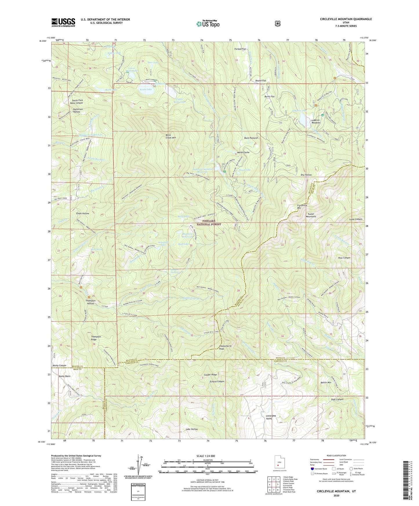
2023 topographic map quadrangle Circleville Mountain in the state of Utah. Scale: 1:24000. Based on the newly updated USGS 7.5' US Topo map series, this map is in the following counties: Beaver, Piute, Garfield, Iron. The map contains contour data, water features, and other items you are used to seeing on USGS maps, but also has updated roads and other features. This is the next generation of topographic maps. Printed on high-quality waterproof paper with UV fade-resistant inks.
Quads adjacent to this one:
West: Kane Canyon
Northwest: Black Ridge
North: Shelly Baldy Peak
Northeast: Delano Peak
East: Circleville
Southeast: Bull Rush Peak
South: Fremont Pass
Southwest: Burnt Peak
This map covers the same area as the classic USGS quad with code o38112b4.
Contains the following named places: Anderson Campground, Anderson Meadow Dam, Anderson Meadow Reservoir, Battle Mountain, Birch Creek Mountain, Birch Lake, Bone Valley, Briggs Camp, Briggs Camp Creek, Buck Pastures, Burnt Flat, Burnt Spring, Chokecherry Peak, Circleville Mountain, Cougar Ridge, Dalley Ditch, Deer Lake, Fullmers Cabins, Kents Lake, Kents Lake Campground, Kents Spring, LaBaron Creek, LeBaron Lake, LeBaron Meadows, Little Twist Creek, Lower Kents Lake, Middle Creek, Middle Fork Birch Creek, Middle Fork South Creek, Middle Kents Lake Number Two Dam, Middle Pine Creek, Mud Lake, Mumford Reservoir, North Fork Birch Creek, North Fork South Creek, Pole Canyon, Ranger Pasture, Rock Lake, Rocky Basin, Rocky Reservoir, Round Flat, Senseball Creek, Senseball Lake, South Fork Birch Creek, South Fork South Creek, Stag Spring, Thompson Hollow, Thompson Ridge, Upper Kents Lake, Upper Kents Lake Number One Dam, Wards Cache, Wildcat Creek, Willow Lake, Wood Lake