MyTopo
Kyune Utah US Topo Map
Couldn't load pickup availability
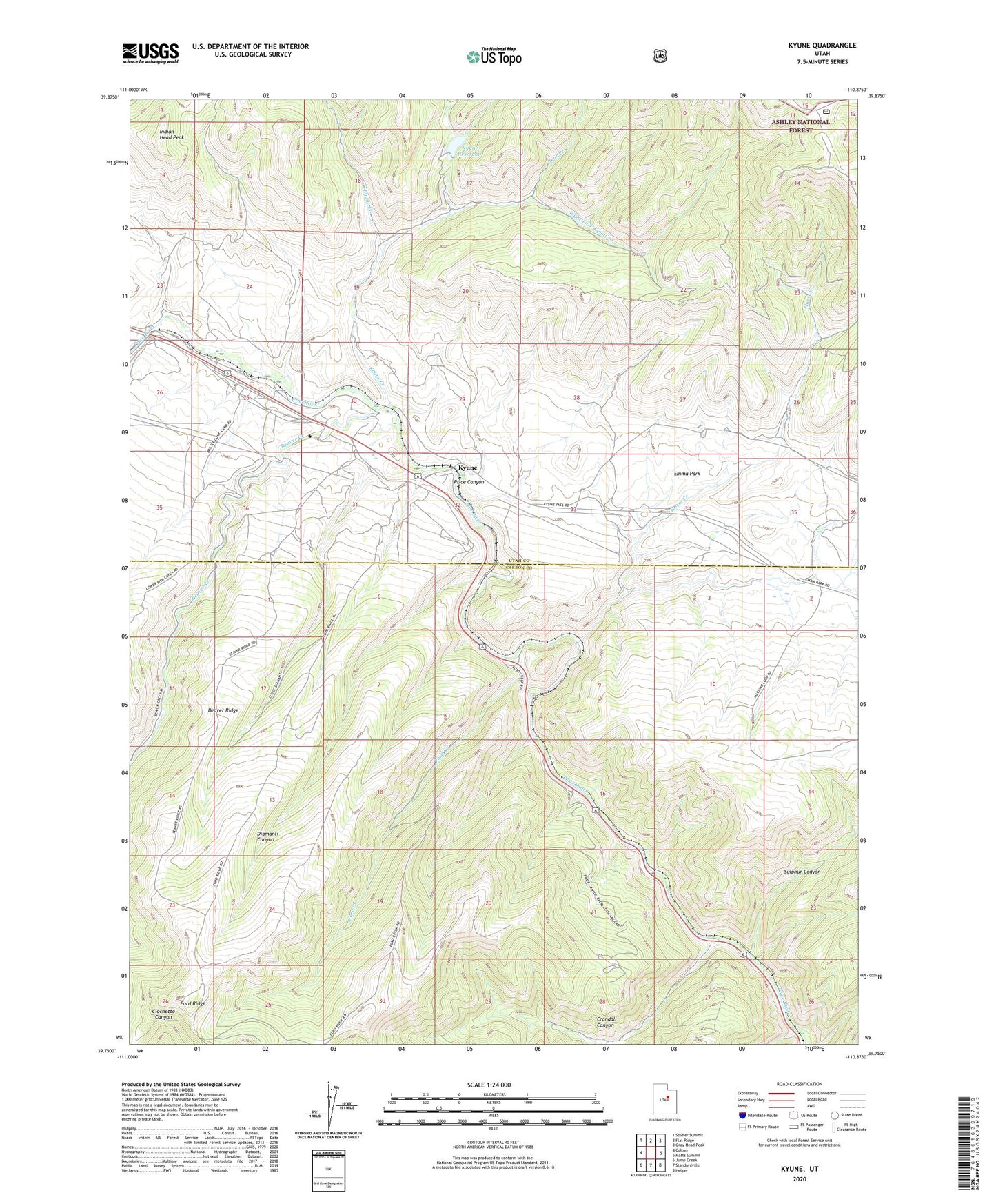
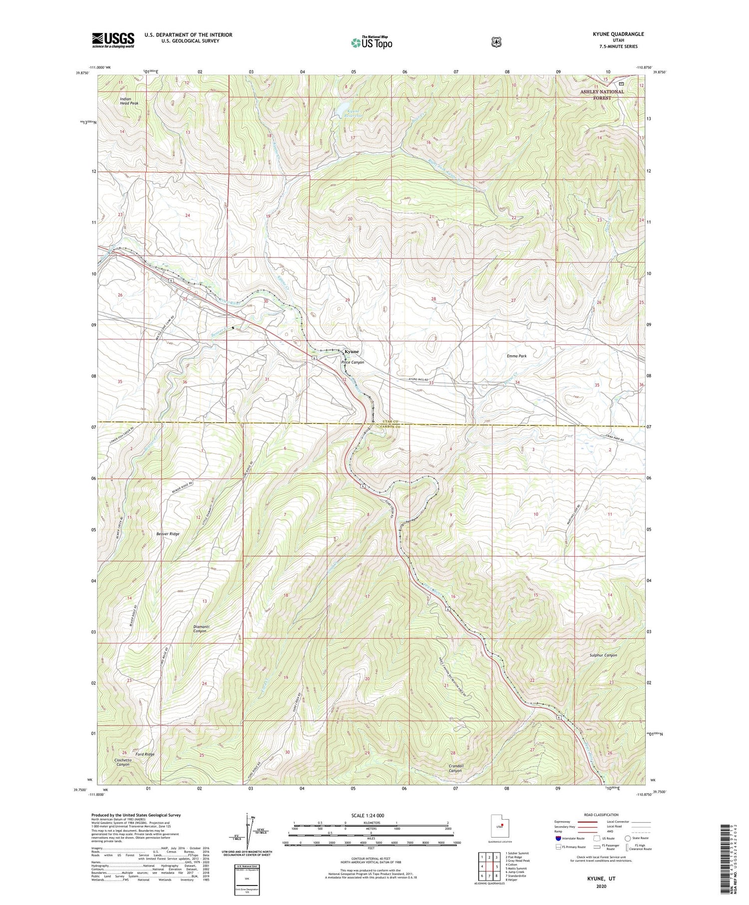
2020 topographic map quadrangle Kyune in the state of Utah. Scale: 1:24000. Based on the newly updated USGS 7.5' US Topo map series, this map is in the following counties: Carbon, Utah. The map contains contour data, water features, and other items you are used to seeing on USGS maps, but also has updated roads and other features. This is the next generation of topographic maps. Printed on high-quality waterproof paper with UV fade-resistant inks.
Quads adjacent to this one:
West: Colton
Northwest: Soldier Summit
North: Flat Ridge
Northeast: Gray Head Peak
East: Matts Summit
Southeast: Helper
South: Standardville
Southwest: Jump Creek
Contains the following named places: Bear Creek, Beaver Creek, Beaver Ridge, Crandall Canyon, Diamanti Canyon, Ford Creek, Ford Ridge, Horse Creek, Indian Head Peak, Kyune, Kyune Creek, Kyune Reservoir, Price Canyon Campgrounds, Price Canyon Recreation Area, Right Fork Kyune Creek, Sulphur Canyon