MyTopo
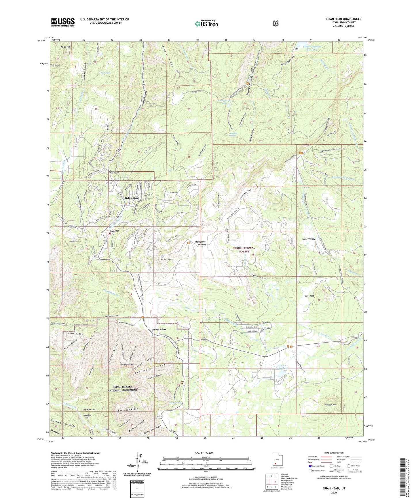
Brian Head Utah US Topo Map
Couldn't load pickup availability
Also explore the Brian Head Forest Service Topo of this same quad for updated USFS data
2023 topographic map quadrangle Brian Head in the state of Utah. Scale: 1:24000. Based on the newly updated USGS 7.5' US Topo map series, this map is in the following counties: Iron. The map contains contour data, water features, and other items you are used to seeing on USGS maps, but also has updated roads and other features. This is the next generation of topographic maps. Printed on high-quality waterproof paper with UV fade-resistant inks.
Quads adjacent to this one:
West: Flanigan Arch
Northwest: Summit
North: Parowan
Northeast: Red Creek Reservoir
East: Panguitch Lake
Southeast: Henrie Knolls
South: Navajo Lake
Southwest: Webster Flat
This map covers the same area as the classic USGS quad with code o37112f7.
Contains the following named places: Adams Barrier, Adams Canyon, Alpine Pond, Alpine Pond Trail, Arch Canyon, Arch Creek, Bear Flat, Braffit Ridge, Brian Head, Brian Head Fire Department, Brian Head Police Department, Brian Head Ski Area, Bristlecone Ridge, Cedar Breaks, Cedar Breaks Amphitheater, Cedar Breaks National Monument, Center Creek, Chessmen Canyon, Chessmen Overlook, Chessmen Ridge, Columbine Canyon, Columbine Ridge, Cresant Hollow, Dark Hollow, Dry Lakes, Hancock Peak, Hendrickson Lake, Highleap Canyon, Jericho Canyon, Labyrinth Canyon, Lavender Canyon, Long Flat, Louder Ranger Station, Lowder Creek, Mammoth Summit, Meadow Hill, Meadow Lodge Lake, Meadow Lodge Lake Dam, Navajo Point, Navajo Ridge, North View, Orange Ridge, Paridise Spring, Rattle Creek, Shooting Star Ridge, Sidney Peaks, Sidney Valley, Snow Ridge, The Highleap, The Meadows, The Quarry, Thunder Ridge Campground, Town of Brian Head, White Hill, ZIP Code: 84719