MyTopo
Chepeta Lake Utah US Topo Map
Couldn't load pickup availability
Also explore the Chepeta Lake Forest Service Topo of this same quad for updated USFS data
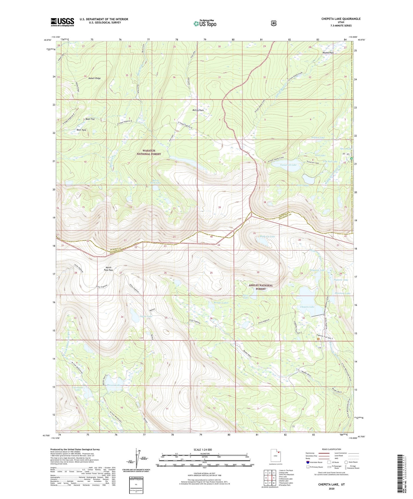
2023 topographic map quadrangle Chepeta Lake in the state of Utah. Scale: 1:24000. Based on the newly updated USGS 7.5' US Topo map series, this map is in the following counties: Duchesne, Summit, Daggett. The map contains contour data, water features, and other items you are used to seeing on USGS maps, but also has updated roads and other features. This is the next generation of topographic maps. Printed on high-quality waterproof paper with UV fade-resistant inks.
Quads adjacent to this one:
West: Fox Lake
Northwest: Hole In The Rock
North: Hoop Lake
Northeast: Phil Pico Mountain
East: Whiterocks Lake
Southeast: Paradise Park
South: Rasmussen Lakes
Southwest: Bollie Lake
This map covers the same area as the classic USGS quad with code o40110g1.
Contains the following named places: Bear Flat, Bear Park, Burnt Fork Lake, Chepeta Dam, Chepeta Lake, Cleveland Lake, Elbow Lake, Fish Lake, Hidden Lake, Jessen Lake, Lily Pad Lake, Lost Lake, McCoy Park, Moccasin Lake, Moccasin Lake Dam, North Pole Pass, Papoose Lake, Papoose Lake Dam, Queant Lake, Reader Lakes, Round Park, Spirit Lake Campground, Spirit Lake Lodge, Spirit Lake Recreation Site, Tamarack Lake, Tamarack Lake Dam, Taylor Lake, Walk-Up Lake, Wigwam Dam, Wigwam Lake