MyTopo
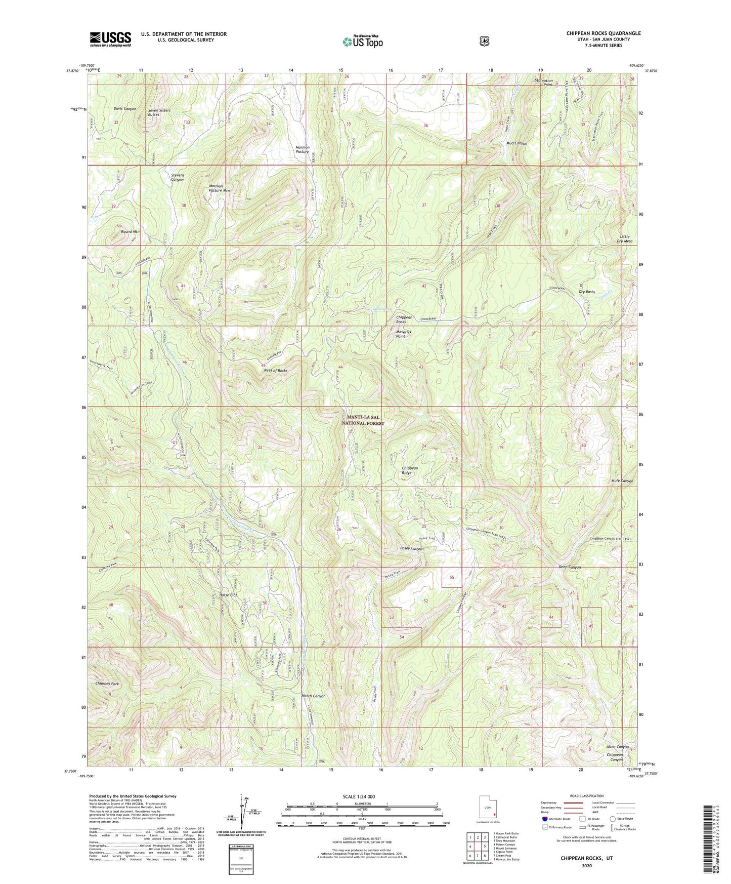
Chippean Rocks Utah US Topo Map
Couldn't load pickup availability
Also explore the Chippean Rocks Forest Service Topo of this same quad for updated USFS data
2023 topographic map quadrangle Chippean Rocks in the state of Utah. Scale: 1:24000. Based on the newly updated USGS 7.5' US Topo map series, this map is in the following counties: San Juan. The map contains contour data, water features, and other items you are used to seeing on USGS maps, but also has updated roads and other features. This is the next generation of topographic maps. Printed on high-quality waterproof paper with UV fade-resistant inks.
Quads adjacent to this one:
West: Poison Canyon
Northwest: House Park Butte
North: Cathedral Butte
Northeast: Shay Mountain
East: Mount Linnaeus
Southeast: Mancos Jim Butte
South: Cream Pots
Southwest: Kigalia Point
This map covers the same area as the classic USGS quad with code o37109g6.
Contains the following named places: Avalanche Mine, Black Bean Mine, Chippean Canyon, Chippean Ridge, Chippean Rocks, Deep Canyon, Dry Basin, Horse Flat, Maverick Point, Maverick Point Overlook, Maverick Visitor Information Site, Mormon Pasture, Mormon Pasture Mountain, Mud Canyon, Mule Canyon, Notch Canyon, Reef of Rocks, Round Mountain, Sand Spring, Seven Sisters Buttes, Starvation Point, The Wilderness