MyTopo
Split Mountain Utah US Topo Map
Couldn't load pickup availability
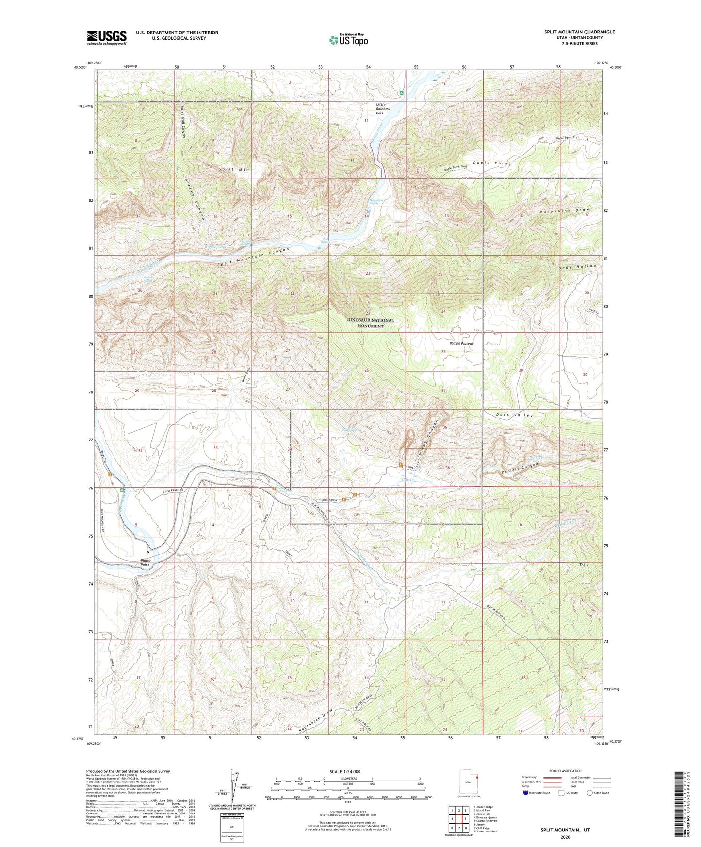
2020 topographic map quadrangle Split Mountain in the state of Utah. Scale: 1:24000. Based on the newly updated USGS 7.5' US Topo map series, this map is in the following counties: Uintah. The map contains contour data, water features, and other items you are used to seeing on USGS maps, but also has updated roads and other features. This is the next generation of topographic maps. Printed on high-quality waterproof paper with UV fade-resistant inks.
Quads adjacent to this one:
West: Dinosaur Quarry
Northwest: Jensen Ridge
North: Island Park
Northeast: Jones Hole
East: Stuntz Reservoir
Southeast: Snake John Reef
South: Cliff Ridge
Southwest: Jensen
Contains the following named places: Beach Draw, Bear Hollow, Cub Creek, Daniels Canyon, Daniels Ranch, Daniels Trail, Dinosaur National Monument, Doc Valley Overlook, Docs Valley, Elder Spring, Green River Campground, Green River Ranger Station, Hog Canyon, Inglesby Rapids, Little Rainbow Park, Mitten Canyon, Moonshine Draw, Moonshine Rapids, Morris Ranch, Placer Point, Rainbow Park Campground, S O B Rapids, Schoolboy Rapids, South Fork Cub Creek, Split Mountain, Split Mountain Landing, Warm Springs, Yampa Plateau