MyTopo
Springdale West Utah US Topo Map
Couldn't load pickup availability
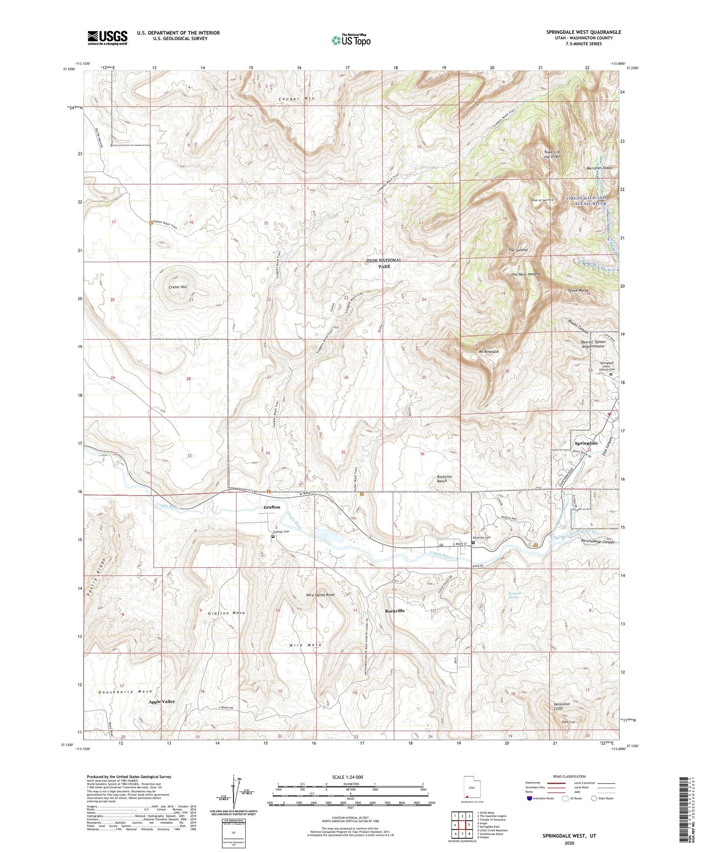
2023 topographic map quadrangle Springdale West in the state of Utah. Scale: 1:24000. Based on the newly updated USGS 7.5' US Topo map series, this map is in the following counties: Washington. The map contains contour data, water features, and other items you are used to seeing on USGS maps, but also has updated roads and other features. This is the next generation of topographic maps. Printed on high-quality waterproof paper with UV fade-resistant inks.
Quads adjacent to this one:
West: Virgin
Northwest: Smith Mesa
North: The Guardian Angels
Northeast: Temple of Sinawava
East: Springdale East
Southeast: Hildale
South: Smithsonian Butte
Southwest: Little Creek Mountain
This map covers the same area as the classic USGS quad with code o37113b1.
Contains the following named places: Altar of Sacrifice, Coalpits Wash, Cougar Mountain, Crater Hill, Eagle Crags, East Fork Virgin River, Grafton, Grafton Cemetery, Grafton Mesa, Grafton Wash, Horse Valley Wash, Huber Wash, Jennings Wash, Meridian Tower, Mount Kinesava, North Fork Virgin River, Obert C Tanner Amphitheater, Parunuweap Canyon, Petrified Forest, Petrified Forest Trail, Rimrock Spring, Rockville, Rockville - Springdale Fire Protection District, Rockville Bench, Rockville Cemetery, Rockville Post Office, Scoggins Wash, South Wash, Springdale Jolley - Gifford Cemetery, Terry Wash, The Sundial, The West Temple, Three Marys, Towers of the Virgin, Town of Rockville, Town of Springdale, Wire Mesa, Wire Valley Knoll, Wire Valley Wash, Zion Canyon, Zion Community Church, ZIP Code: 84763