MyTopo
The Guardian Angels Utah US Topo Map
Couldn't load pickup availability
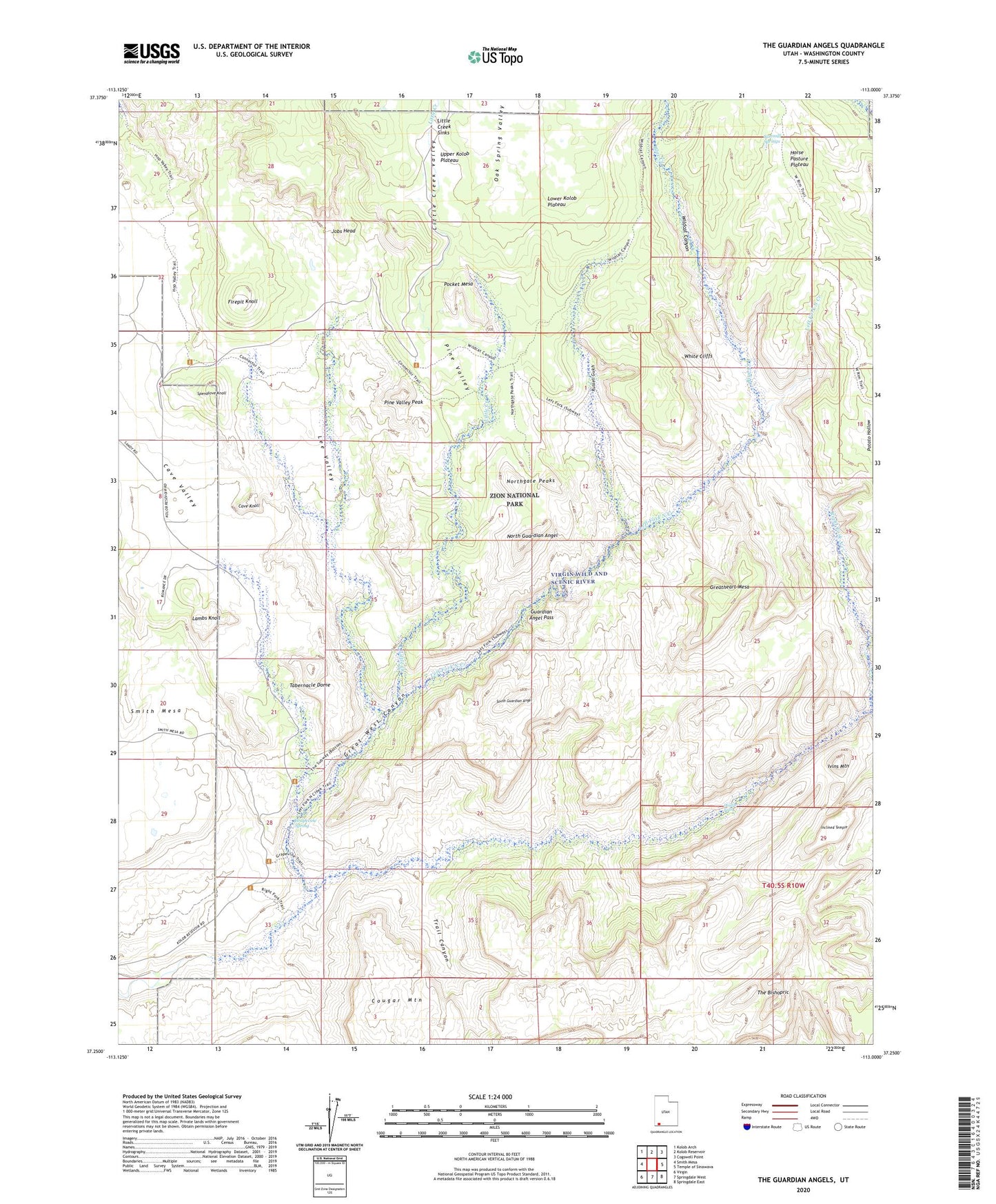
2023 topographic map quadrangle The Guardian Angels in the state of Utah. Scale: 1:24000. Based on the newly updated USGS 7.5' US Topo map series, this map is in the following counties: Washington. The map contains contour data, water features, and other items you are used to seeing on USGS maps, but also has updated roads and other features. This is the next generation of topographic maps. Printed on high-quality waterproof paper with UV fade-resistant inks.
Quads adjacent to this one:
West: Smith Mesa
Northwest: Kolob Arch
North: Kolob Reservoir
Northeast: Cogswell Point
East: Temple of Sinawava
Southeast: Springdale East
South: Springdale West
Southwest: Virgin
This map covers the same area as the classic USGS quad with code o37113c1.
Contains the following named places: Blue Creek, Cave Knoll, Cave Valley, Double Falls, Firepit Knoll, Grapevine Spring, Grapevine Wash, Great West Canyon, Greatheart Mesa, Guardian Angel Pass, Inclined Temple, Ivins Mountain, Jobs Head, Lambs Knoll, Lava Point Trail, Lee Valley, Left Fork North Creek, Little Creek, Little Creek Sinks, Little Creek Valley, Midville Site, North Guardian Angel, Northgate Peaks, Oak Spring Valley, Pine Spring Wash, Pine Valley, Pine Valley Peak, Pocket Mesa, Right Fork North Creek, Russell Gulch, Sawmill Springs, South Guardian Angel, Spendlove Knoll, Tabernacle Dome, The Bishopric, The Subway, Trail Canyon, Virgin Wild and Scenic River, Wildcat Canyon, Wolf Spring Wash, Zion National Park, Zion National Park Post Office, Zion Wilderness, ZIP Code: 84779