MyTopo
Hildale Utah US Topo Map
Couldn't load pickup availability
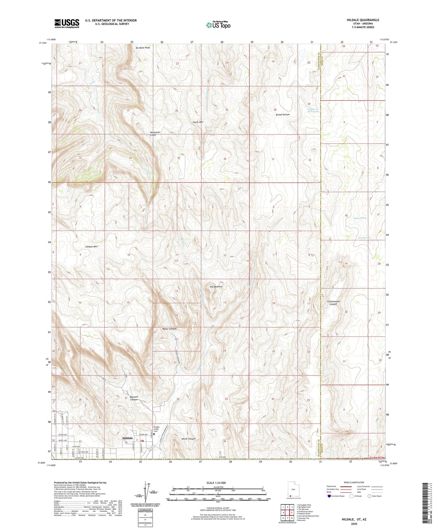
2023 topographic map quadrangle Hildale in the state of Utah. Scale: 1:24000. Based on the newly updated USGS 7.5' US Topo map series, this map is in the following counties: Washington, Kane, Mohave. The map contains contour data, water features, and other items you are used to seeing on USGS maps, but also has updated roads and other features. This is the next generation of topographic maps. Printed on high-quality waterproof paper with UV fade-resistant inks.
Quads adjacent to this one:
West: Smithsonian Butte
Northwest: Springdale West
North: Springdale East
Northeast: The Barracks
East: Elephant Butte
Southeast: Moccasin
South: Colorado City
Southwest: Lost Spring Mountain East
This map covers the same area as the classic USGS quad with code o37112a8.
Contains the following named places: Birch Creek, Canaan Mountain RV Closure Area, Canaan Mountain Wilderness, Cappies Rock Spring, City of Hildale, Goat Springs, Hildale, Hildale Fire Department, Hildale Infant Cemetery, Maxwell Canyon, Phelps School, Ronso Spring, Skunk Canyon, South Mountain, Squirrel Creek, The Beehive, Water Canyon, ZIP Code: 84784