MyTopo
Straight Canyon Utah US Topo Map
Couldn't load pickup availability
Also explore the Straight Canyon Forest Service Topo of this same quad for updated USFS data
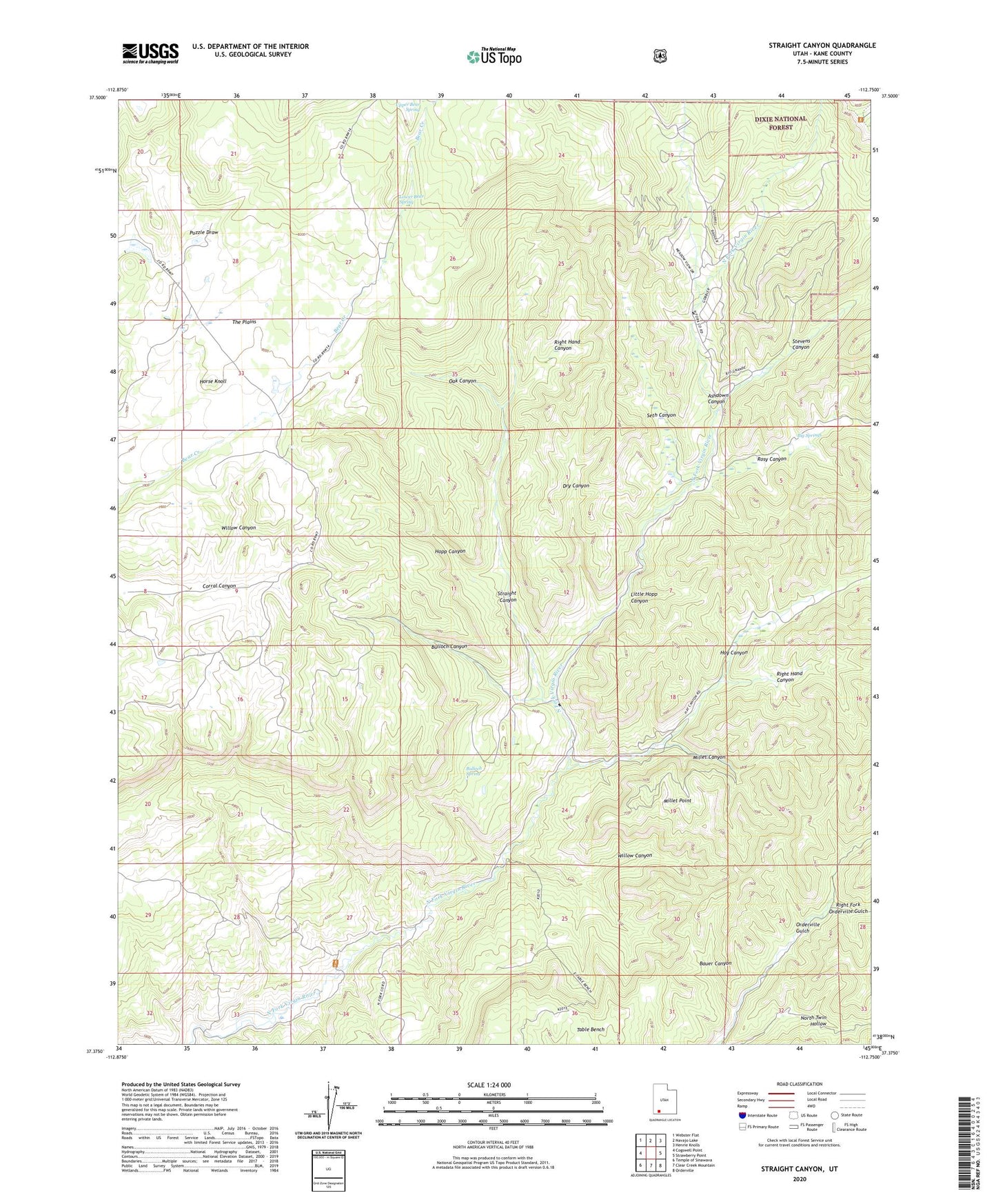
2023 topographic map quadrangle Straight Canyon in the state of Utah. Scale: 1:24000. Based on the newly updated USGS 7.5' US Topo map series, this map is in the following counties: Kane. The map contains contour data, water features, and other items you are used to seeing on USGS maps, but also has updated roads and other features. This is the next generation of topographic maps. Printed on high-quality waterproof paper with UV fade-resistant inks.
Quads adjacent to this one:
West: Cogswell Point
Northwest: Webster Flat
North: Navajo Lake
Northeast: Henrie Knolls
East: Strawberry Point
Southeast: Orderville
South: Clear Creek Mountain
Southwest: Temple of Sinawava
This map covers the same area as the classic USGS quad with code o37112d7.
Contains the following named places: Ashdown Canyon, Bauer Canyon, Big Springs, Bulloch Canyon, Bulloch Spring, Chamberlains Ranch, Dry Canyon, Hay Canyon, Hopp Canyon, Horse Knoll, Little Hopp Canyon, Lower Bear Spring, Millet Canyon, Millet Point, Oak Canyon, Right Fork Orderville Gulch, Right Hand Canyon, Rosy Canyon, Seth Canyon, Stevens Canyon, Straight Canyon, The Plains, Upper Bear Spring, Willow Canyon