MyTopo
Cogswell Point Utah US Topo Map
Couldn't load pickup availability
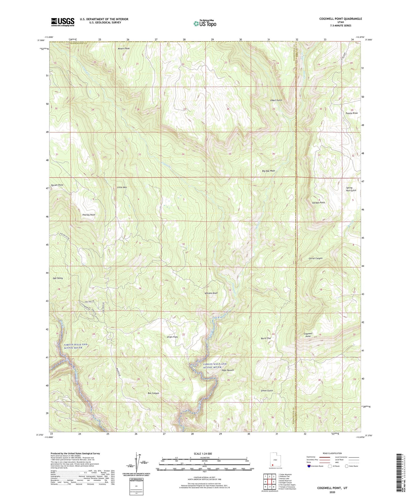
2023 topographic map quadrangle Cogswell Point in the state of Utah. Scale: 1:24000. Based on the newly updated USGS 7.5' US Topo map series, this map is in the following counties: Washington, Kane, Iron. The map contains contour data, water features, and other items you are used to seeing on USGS maps, but also has updated roads and other features. This is the next generation of topographic maps. Printed on high-quality waterproof paper with UV fade-resistant inks.
Quads adjacent to this one:
West: Kolob Reservoir
Northwest: Cedar Mountain
North: Webster Flat
Northeast: Navajo Lake
East: Straight Canyon
Southeast: Clear Creek Mountain
South: Temple of Sinawava
Southwest: The Guardian Angels
This map covers the same area as the classic USGS quad with code o37112d8.
Contains the following named places: Bear Creek, Big Birch, Big Oak Wash, Box Canyon, Burnt Flat, Cogswell Point, Corral Canyon, Crystal Creek, Deep Creek North Wilderness, Deep Creek Wilderness, Fife Creek, Gordon Point, Hogs Heaven, Little Mountain, Oak Creek, Oak Valley, O'Neil Gulch, Puzzle Draw, Spring Run, Spring Run Gulch, The Forks, Thorley Point, Virgin Flats, Volcano Knoll, West Fork Deep Canyon