MyTopo
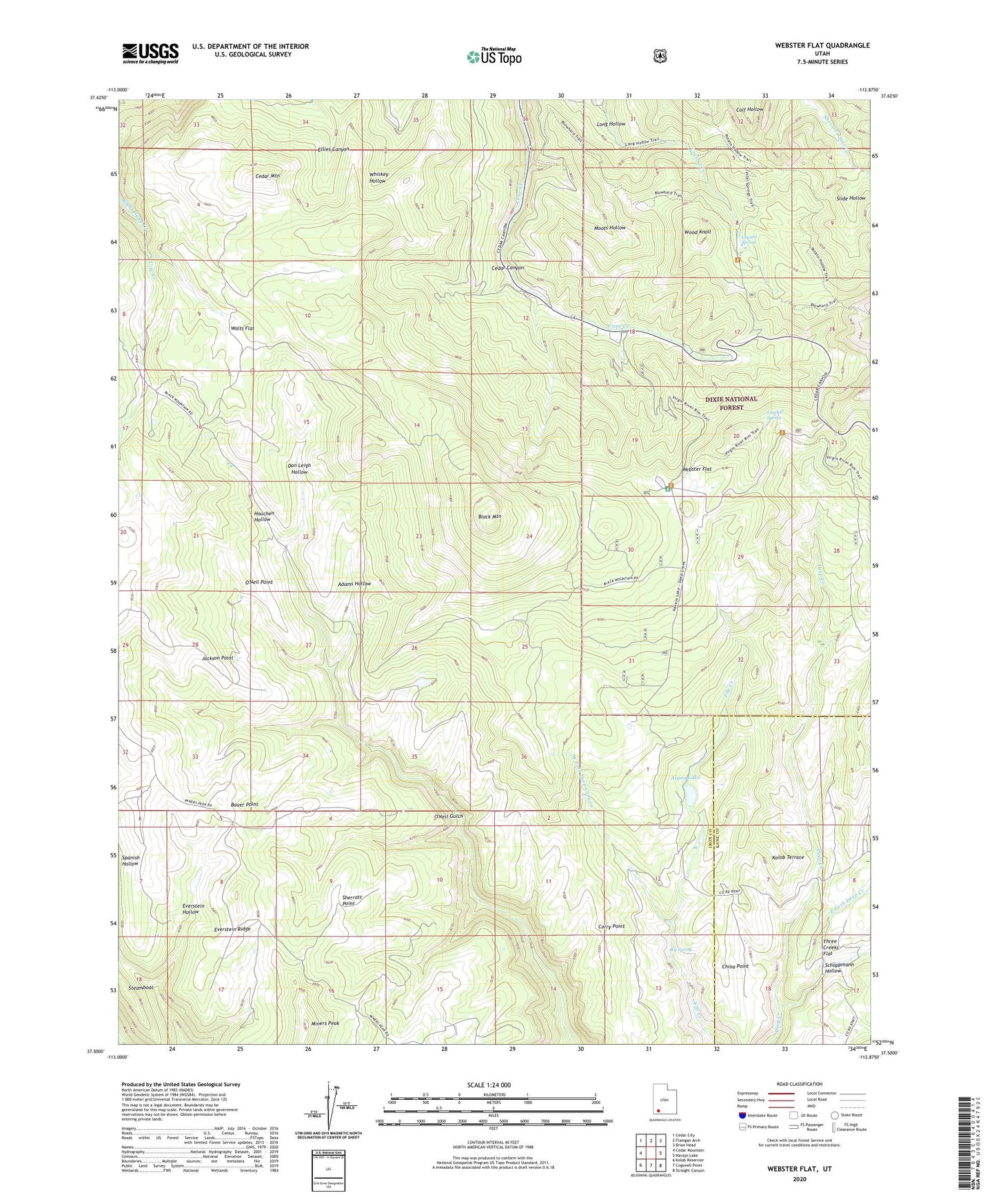
Webster Flat Utah US Topo Map
Couldn't load pickup availability
Also explore the Webster Flat Forest Service Topo of this same quad for updated USFS data
2023 topographic map quadrangle Webster Flat in the state of Utah. Scale: 1:24000. Based on the newly updated USGS 7.5' US Topo map series, this map is in the following counties: Iron, Kane. The map contains contour data, water features, and other items you are used to seeing on USGS maps, but also has updated roads and other features. This is the next generation of topographic maps. Printed on high-quality waterproof paper with UV fade-resistant inks.
Quads adjacent to this one:
West: Cedar Mountain
Northwest: Cedar City
North: Flanigan Arch
Northeast: Brian Head
East: Navajo Lake
Southeast: Straight Canyon
South: Cogswell Point
Southwest: Kolob Reservoir
This map covers the same area as the classic USGS quad with code o37112e8.
Contains the following named places: Adams Hollow, Aspen Lake, Bauer Point, Big Spring, Black Mountain, Cedar Canyon Campground, Cedar Canyon Ski Area, China Point, Corry Point, Crystal Creek, Crystal Spring, Dan Leigh Hollow, Deer Haven Campground, East Fork Deep Creek, Everstein Hollow, Everstein Ridge, Houchen Hollow, Jackson Point, Kolob Terrace, Lundell Spring, Miners Peak, Moots Hollow, O'Neil Point, Schoppmann Hollow, Sherratt Point, Slide Hollow, Steamboat, Three Creeks Flat, Urie Creek, Walts Flat, Webster Flat, Wood Knoll, Wood Ranch, Zion Overlook