MyTopo
Tony Grove Creek Utah US Topo Map
Couldn't load pickup availability
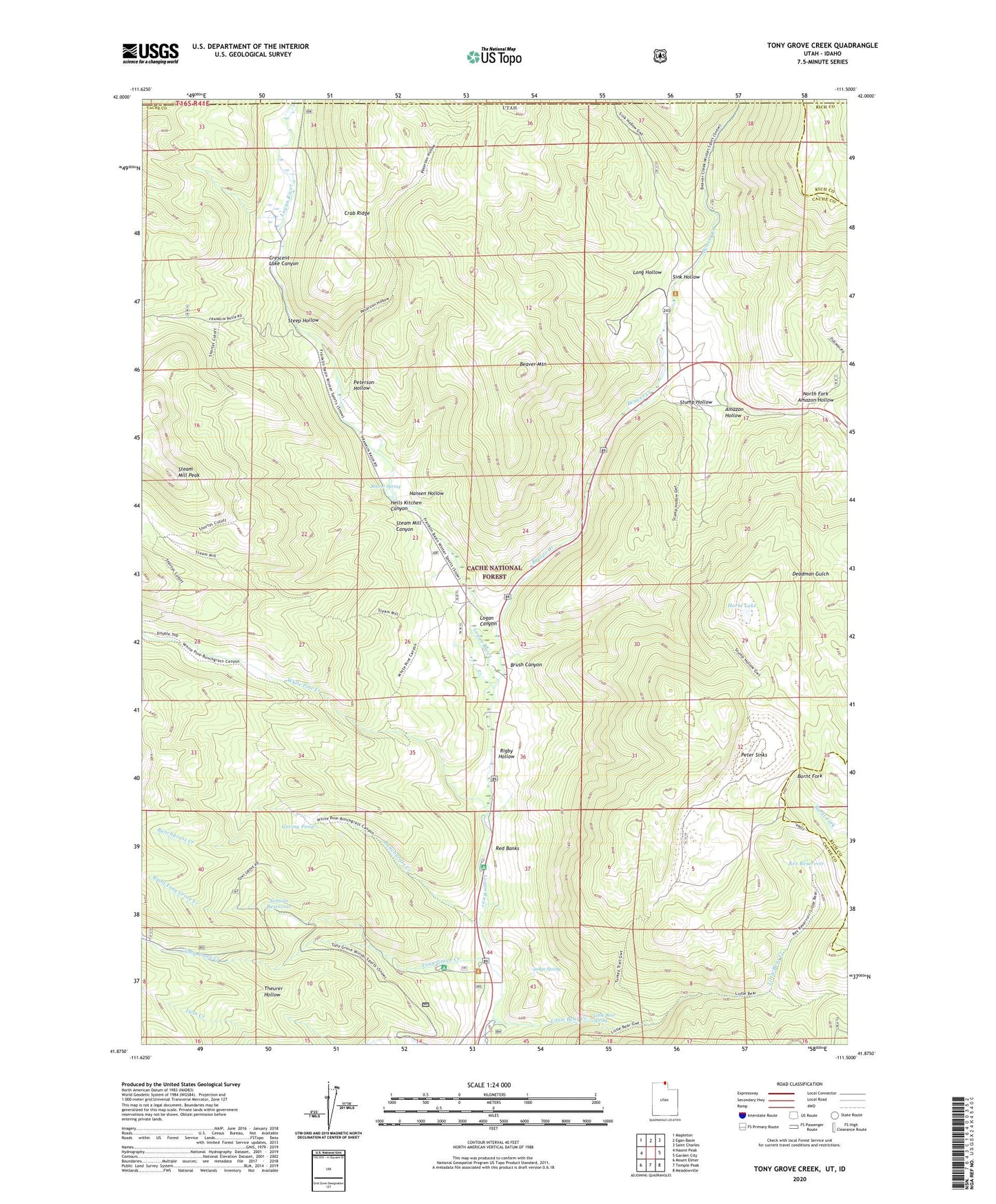
2020 topographic map quadrangle Tony Grove Creek in the state of Utah. Scale: 1:24000. Based on the newly updated USGS 7.5' US Topo map series, this map is in the following counties: Cache, Rich, Franklin, Bear Lake. The map contains contour data, water features, and other items you are used to seeing on USGS maps, but also has updated roads and other features. This is the next generation of topographic maps. Printed on high-quality waterproof paper with UV fade-resistant inks.
Quads adjacent to this one:
West: Naomi Peak
Northwest: Mapleton
North: Egan Basin
Northeast: Saint Charles
East: Garden City
Southeast: Meadowville
South: Temple Peak
Southwest: Mount Elmer
Contains the following named places: Amazon Hollow, Amazon Mine, Beaver Creek, Beaver Mountain, Beaver Mountain Ski Area, Beaver Spring, Brush Canyon, Bunchgrass Creek, Crab Ridge, Crescent Lake Canyon, Goring Pond, Hansen Hollow, Hells Kitchen Canyon, Horse Lake, Lewis M Turner Campground, Little Bear Creek, Little Bear Spring, Long Hollow, North Fork Amazon Hollow, Peter Sinks, Peterson Hollow, Red Banks, Red Banks Campground, Rex Reservoir, Rigby Hollow, Right Fork, Sedge Spring, Selman Reservoir, Sink Hollow, Steam Mill Canyon, Steam Mill Peak, Steep Hollow, Stump Hollow, Tony Grove, Tony Grove Creek, Tony Grove Memorial Guard Station, Utah State University Forestry Field Station, White Pine Creek