MyTopo
Tucker Utah US Topo Map
Couldn't load pickup availability
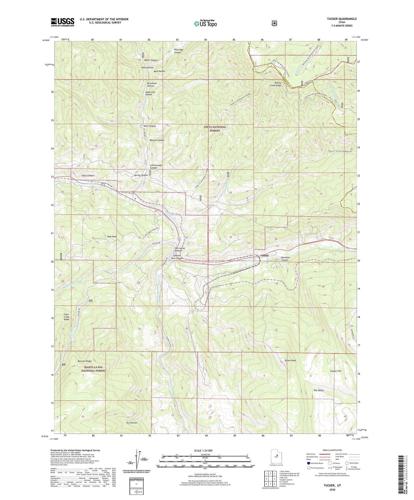
2020 topographic map quadrangle Tucker in the state of Utah. Scale: 1:24000. Based on the newly updated USGS 7.5' US Topo map series, this map is in the following counties: Utah, Wasatch. The map contains contour data, water features, and other items you are used to seeing on USGS maps, but also has updated roads and other features. This is the next generation of topographic maps. Printed on high-quality waterproof paper with UV fade-resistant inks.
Quads adjacent to this one:
West: Mill Fork
Northwest: Rays Valley
North: Strawberry Reservoir SW
Northeast: Strawberry Reservoir SE
East: Soldier Summit
Southeast: Colton
South: Scofield Reservoir
Southwest: C Canyon
Contains the following named places: Baker Canyon, Bennion Creek, Clear Creek, Cottonwood Canyon, Coyote Flat, Davidson Canyon, Detour, Drunkard Hollow, Gilluly, Hicks Canyon, High Peak, Indian Creek, Left Fork Clear Creek, Mine Hollow, Mud Hollow, Partridge Canyon, Right Fork Clear Creek, Scenic, Sky View, Soberville Hollow, Spring Canyon, Starvation Canyon, Starvation Creek, Starvation Wildlife Management Area, Tie Fork, Tucker, Tucker Peak, Tucker Rest Area, Watson Canyon, West Canyon