MyTopo
Acord Lakes Utah US Topo Map
Couldn't load pickup availability
Also explore the Acord Lakes Forest Service Topo of this same quad for updated USFS data
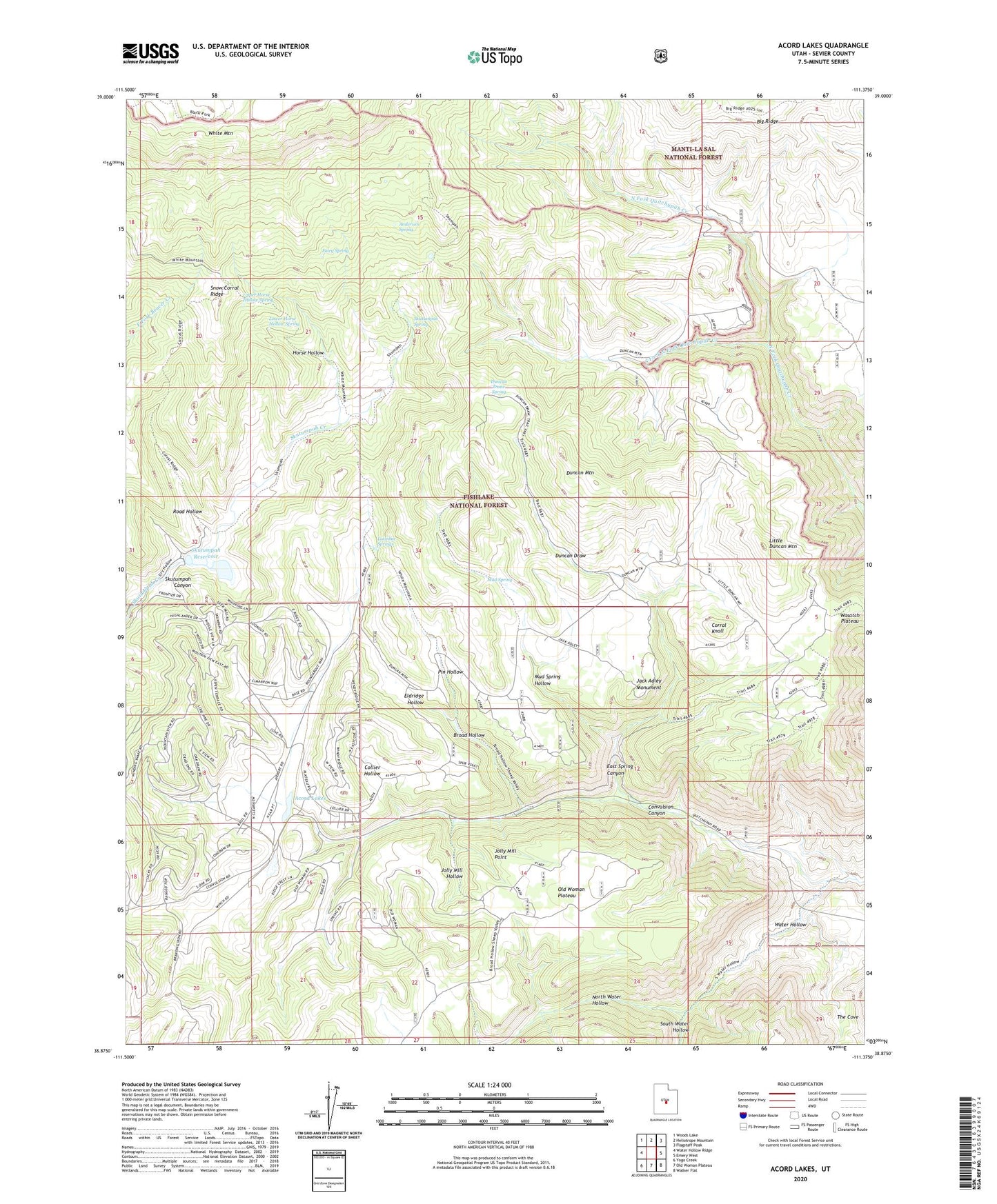
2023 topographic map quadrangle Acord Lakes in the state of Utah. Scale: 1:24000. Based on the newly updated USGS 7.5' US Topo map series, this map is in the following counties: Sevier. The map contains contour data, water features, and other items you are used to seeing on USGS maps, but also has updated roads and other features. This is the next generation of topographic maps. Printed on high-quality waterproof paper with UV fade-resistant inks.
Quads adjacent to this one:
West: Water Hollow Ridge
Northwest: Woods Lake
North: Heliotrope Mountain
Northeast: Flagstaff Peak
East: Emery West
Southeast: Walker Flat
South: Old Woman Plateau
Southwest: Yogo Creek
This map covers the same area as the classic USGS quad with code o38111h4.
Contains the following named places: Acord Lakes, Anderson Spring, Big Ridge, Broad Hollow, Collier Hollow, Convulsion Canyon, Convulsion Coal Mine, Corral Knoll, Duncan Draw, Duncan Draw Spring, Duncan Mountain, East Spring Canyon, Eldridge Hollow, Fairy Spring, Horse Hollow, Jack Adley Monument, Jolly Mill Hollow, Jolly Mill Point, Little Duncan Mountain, Lizonbee Administrative Site, Lizonbee Springs, Lower Horse Hollow Spring, Lunds Cabin, Mud Spring, Mud Spring Hollow, North Water Hollow, Pin Hollow, Road Hollow, Skutumpah Dam, Skutumpah Reservoir, Skutumpah Spring, Snow Corral Ridge, South Fork North Fork Quitchupah Creek, South Water Hollow, The Cove, Upper Horse Hollow Spring, Water Hollow, White Mountain