MyTopo
Bloomfield Vermont US Topo Map
Couldn't load pickup availability
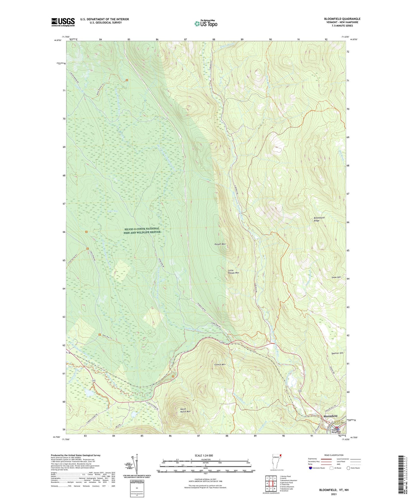
2024 topographic map quadrangle Bloomfield in the states of New Hampshire, Vermont. Scale: 1:24000. Based on the newly updated USGS 7.5' US Topo map series, this map is in the following counties: Essex, Coos. The map contains contour data, water features, and other items you are used to seeing on USGS maps, but also has updated roads and other features. This is the next generation of topographic maps. Printed on high-quality waterproof paper with UV fade-resistant inks.
Quads adjacent to this one:
West: Spectacle Pond
Northwest: Norton Pond
North: Averill
Northeast: Monadnock Mountain
East: Tinkerville
Southeast: Stratford
Southwest: Seneca Mountain
This map covers the same area as the classic USGS quad with code o44071g6.
Contains the following named places: Big Dam, Black Branch Nulhegan River, Bloomfield, Bloomfield Ridge, Brooks Dam, Buzzell Dam, Camp Number Fifteen, Camp Number Five, Camp Number Four, Camp Number Seventeen, Camp Number Six, Camp Number Ten, Camp Number Three, Dam Number One, Dam Number Three, Dam Number Two, East Branch Nulhegan River, First Brook, Fisher Brook, French Mountain, Hibbard Brook, Little Potash Mountain, Logger Branch, Mink Brook, North Branch Nulhegan River, North Notch Mountain, North Stratford, North Stratford Post Office, Nulhegan River, Peanut Dam, Potash Mountain, Second Brook, Silvio O Conte National Fish and Wildlife Refuge, Spencer Hill, Stevens Brook, Stone Dam, Stratford Police Department, Town of Bloomfield, Town of Lewis, Yellow Bogs, Yellow Branch Nulhegan River