MyTopo
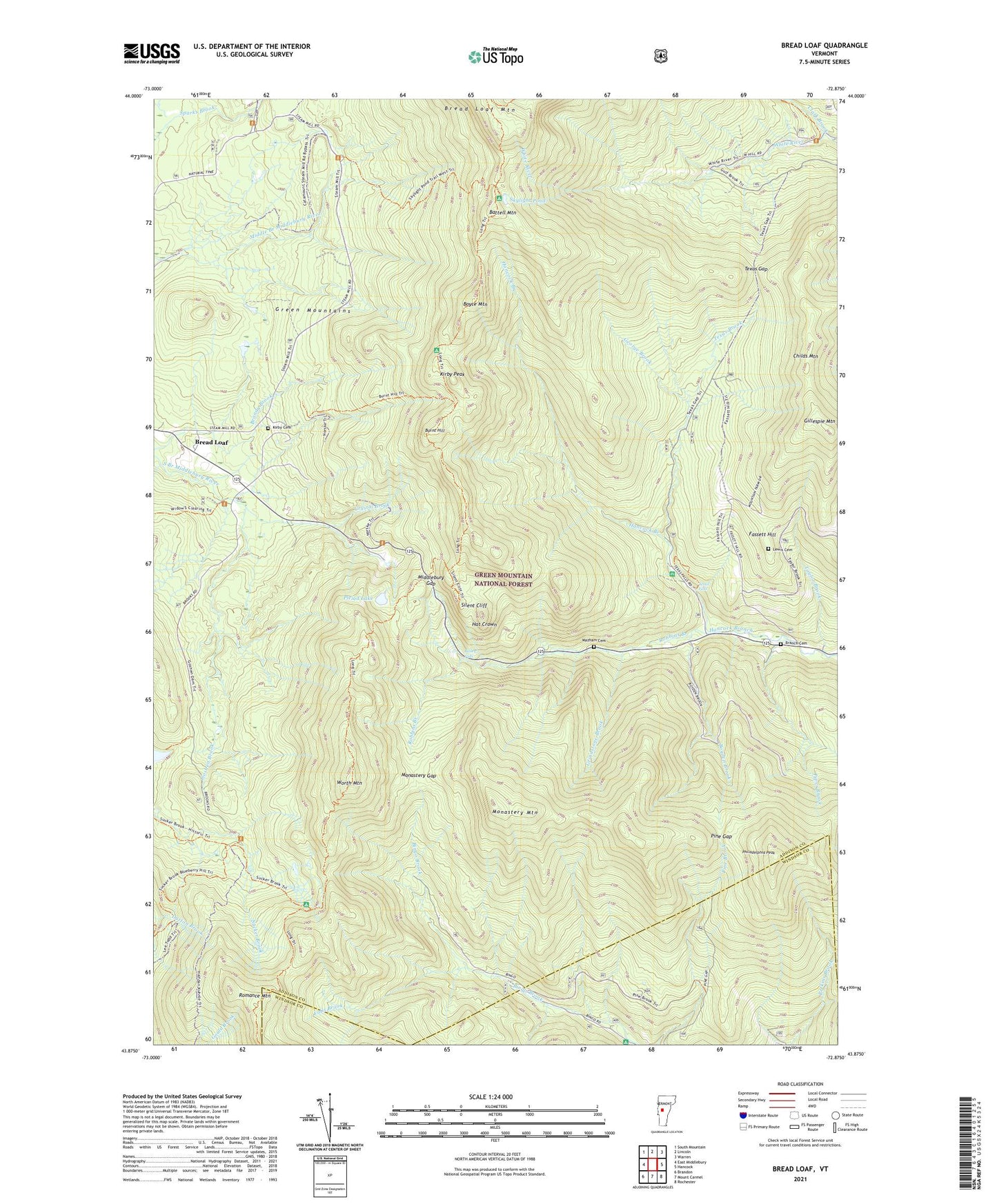
Bread Loaf Vermont US Topo Map
Couldn't load pickup availability
Also explore the Bread Loaf Forest Service Topo of this same quad for updated USFS data
2024 topographic map quadrangle Bread Loaf in the state of Vermont. Scale: 1:24000. Based on the newly updated USGS 7.5' US Topo map series, this map is in the following counties: Addison, Windsor. The map contains contour data, water features, and other items you are used to seeing on USGS maps, but also has updated roads and other features. This is the next generation of topographic maps. Printed on high-quality waterproof paper with UV fade-resistant inks.
Quads adjacent to this one:
West: East Middlebury
Northwest: South Mountain
North: Lincoln
Northeast: Warren
East: Hancock
Southeast: Rochester
South: Mount Carmel
Southwest: Brandon
This map covers the same area as the classic USGS quad with code o43072h8.
Contains the following named places: Bailey Falls, Battell Mountain, Battell Park, Bingo Camp, Boyce Mountain, Boyce Shelter, Boyden Brook, Branch Cemetery, Branch School, Bread Loaf, Bread Loaf School of English, Burnt Hill, Burnt Hill Trail, Childs Mountain, Clark Brook, Crystal Brook, Falls Brook, Fassett Hill, George Brook, Gillespie Mountain, Goshen Brook, Grindstone Brook, Hat Crown, Joseph Battell Wilderness, Kirby Cemetery, Kirby Peak, Lewis Cemetery, Long Trail, Mazham Cemetery, Middlebury College Snow Bowl, Middlebury Gap, Middlebury Summer College, Monastery Gap, Monastery Mountain, Philadelphia Peak, Pine Gap, Piper Brook, Pleiad Lake, Pleiad Shelter, Rikert Ski Touring Center Bread Loaf Campus, Robbins Branch, Romance Mountain, Silent Cliff, Skylight Lodge, Skylight Pond, Skylight Pond Trail, Sucker Brook Shelter, Sucker Brook Trail, Taylor Brook, Texas Brook, Texas Falls, Texas Falls Picnic Area, Texas Falls Picnic Grounds, Texas Gap, Texas School, Town of Hancock, Town of Ripton, Windows Trail, Worth Mountain, Worth Mountain Lodge, ZIP Codes: 05748, 05766