MyTopo
Marshfield Vermont US Topo Map
Couldn't load pickup availability
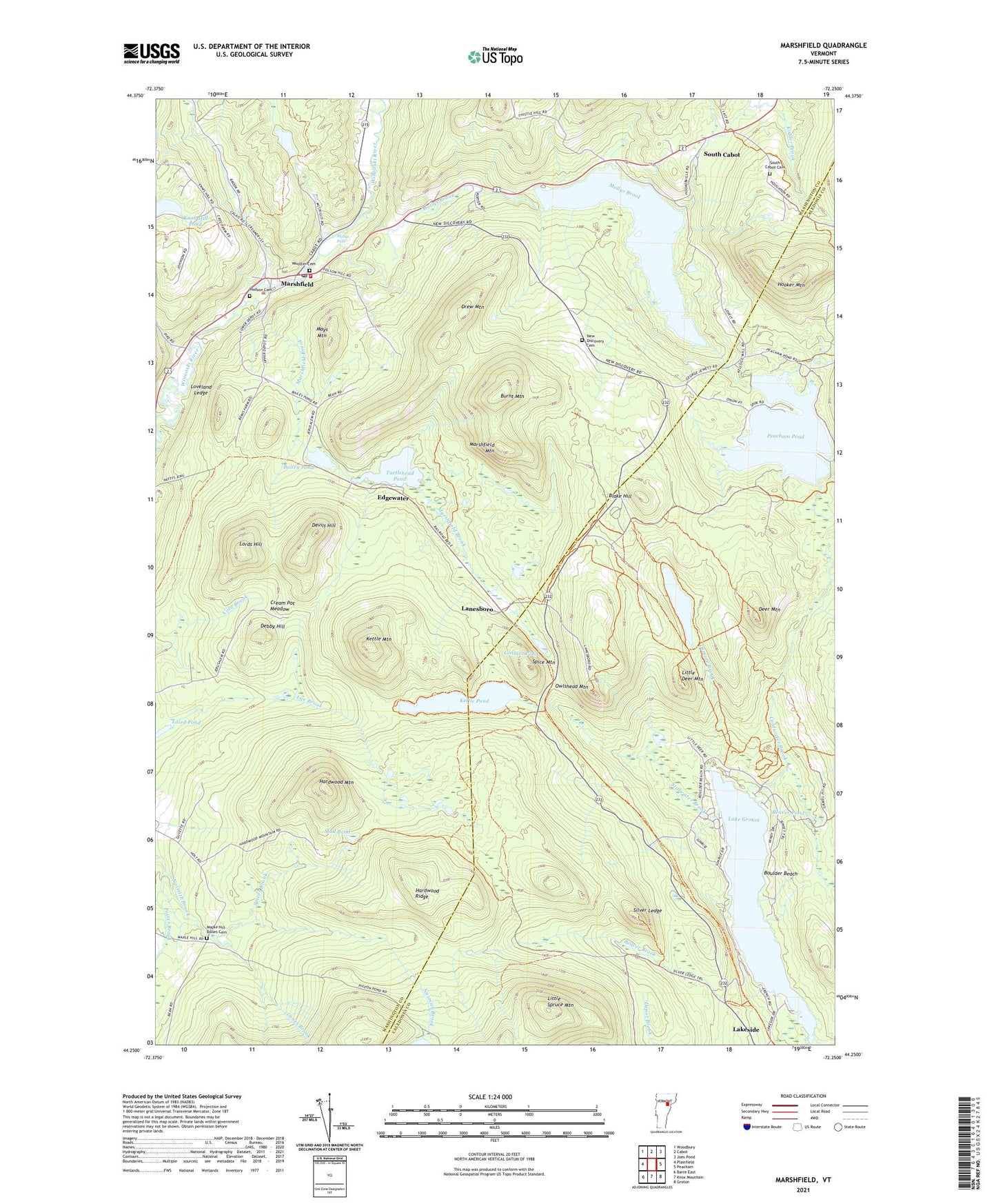
2024 topographic map quadrangle Marshfield in the state of Vermont. Scale: 1:24000. Based on the newly updated USGS 7.5' US Topo map series, this map is in the following counties: Washington, Caledonia. The map contains contour data, water features, and other items you are used to seeing on USGS maps, but also has updated roads and other features. This is the next generation of topographic maps. Printed on high-quality waterproof paper with UV fade-resistant inks.
Quads adjacent to this one:
West: Plainfield
Northwest: Woodbury
North: Cabot
Northeast: Joes Pond
East: Peacham
Southeast: Groton
South: Knox Mountain
Southwest: Barre East
This map covers the same area as the classic USGS quad with code o44072c3.
Contains the following named places: Bailey Pond, Bailey Pond Dam, Beaver Brook, Beaver Pond, Big Deer Campground, Big Deer Mountain Trail, Big Deer Recreation Area, Blake Hill, Boulder Beach, Boulder Beach Recreation Area, Burnt Mountain, Christ Covenant Ministries, Coldwater Brook, Coldwater Brook Trail, Cream Pot Meadow, Debby Hill, Deer Mountain, Depot Brook, Devils Hill, Drew Mountain, Edgewater, Federated Church, Goslant Pond, Groton Nature Center, Groton Pond Dam, Groton State Forest, Groton State Forest Nature Trail, Hardwood Mountain, Hardwood Ridge, Hooker Mountain, Hosmer Brook Trail, Hudson Cemetery, Jaquith Public Library, Kettle Mountain, Kettle Pond, Kettle Pond Group Camping Area, Kettle Pond Trail, Kidder Brook, Knob Hill Pond, Laird Pond, Laird Pond Dam, Lake Groton, Lakeside, Lanes Brook, Lanesboro, Little Deer Mountain, Little Deer Trail, Little Spruce Mountain, Lords Hill, Loveland Ledge, Maple Hill-Bolles Cemetery, Marshfield, Marshfield Brook, Marshfield Fire Department, Marshfield Mountain, Marshfield Municipal Forest, Marshfield Number 6 Dam, Marshfield Post Office, Marshfield Station, Mays Mountain, Mollys Brook, Mollys Falls, Mollys Falls Pond, Mud Pond, New Discovery Campground, New Discovery Cemetery, New Discovery Recreation Area, Osmore Brook, Osmore Pond, Osmore Pond Hiking Loop, Osmore Pond Picnic Shelter, Owls Head Trail, Owlshead Mountain, Peacham Corner, Peacham Pond, Peacham Pond Dam, Richards Dam, Silver Ledge, Silver Ledge Trail, South Cabot, South Cabot Cemetery, Spice Mountain, Spicer Brook, Stillwater Brook, Stillwater Campground, Stillwater Recreation Area, Sucker Brook, Thistle Hill Camping Area, Town of Marshfield, Turtlehead Pond, Village of Marshfield, Wooster Cemetery, ZIP Code: 05658