MyTopo
Woodbury Vermont US Topo Map
Couldn't load pickup availability
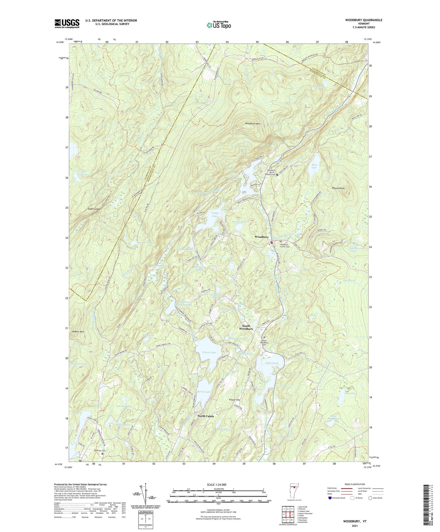
2024 topographic map quadrangle Woodbury in the state of Vermont. Scale: 1:24000. Based on the newly updated USGS 7.5' US Topo map series, this map is in the following counties: Washington, Lamoille, Caledonia. The map contains contour data, water features, and other items you are used to seeing on USGS maps, but also has updated roads and other features. This is the next generation of topographic maps. Printed on high-quality waterproof paper with UV fade-resistant inks.
Quads adjacent to this one:
West: Mount Worcester
Northwest: Morrisville
North: Wolcott
Northeast: Caspian Lake
East: Cabot
Southeast: Marshfield
South: Plainfield
Southwest: Montpelier
This map covers the same area as the classic USGS quad with code o44072d4.
Contains the following named places: Blake Falls, Blue Pond, Buck Lake, Buck Lake Brook, Buck Lake Wildlife Management Area, Calais Post Office, Christian Youth Council Building, Cranberry Meadow Pond, Curtis Pond, Curtis Pond Dam, Dobson Pond, Dugar Brook, Eagle Ledge, Forest Lake, Foster Hill, Goodall Pond, Greenwood Lake, Hardwood Flats School, Hardwood Pond, Harry Pond, Hobart Mountain, King Ponds, Leech Pond, Little Mud Pond, Little Pond, Maple Corner, Mirror Lake, Mirror Lake Dam, Mud Pond, North Calais, North Calais School, Pickett Pond, Robinson Cemetery, Round Knoll, Sabin Pond, Shadow Pond, Slayton Pond, Smith Pond, South Woodbury, South Woodbury Cemetery, South Woodbury Congregational Church, Tabor Pond, Town of Woodbury, Valley Lake, Valley Lake Dam, Walton Pond, Watson Pond, Wheeler Pond, Woodbury, Woodbury Center Cemetery, Woodbury Elementary School, Woodbury Mountain, Woodbury Post Office, Woodbury Town Forest, Woodbury Upper Dam, Woodbury Volunteer Fire Department, ZIP Codes: 05648, 05650, 05681