MyTopo
Plainfield Vermont US Topo Map
Couldn't load pickup availability
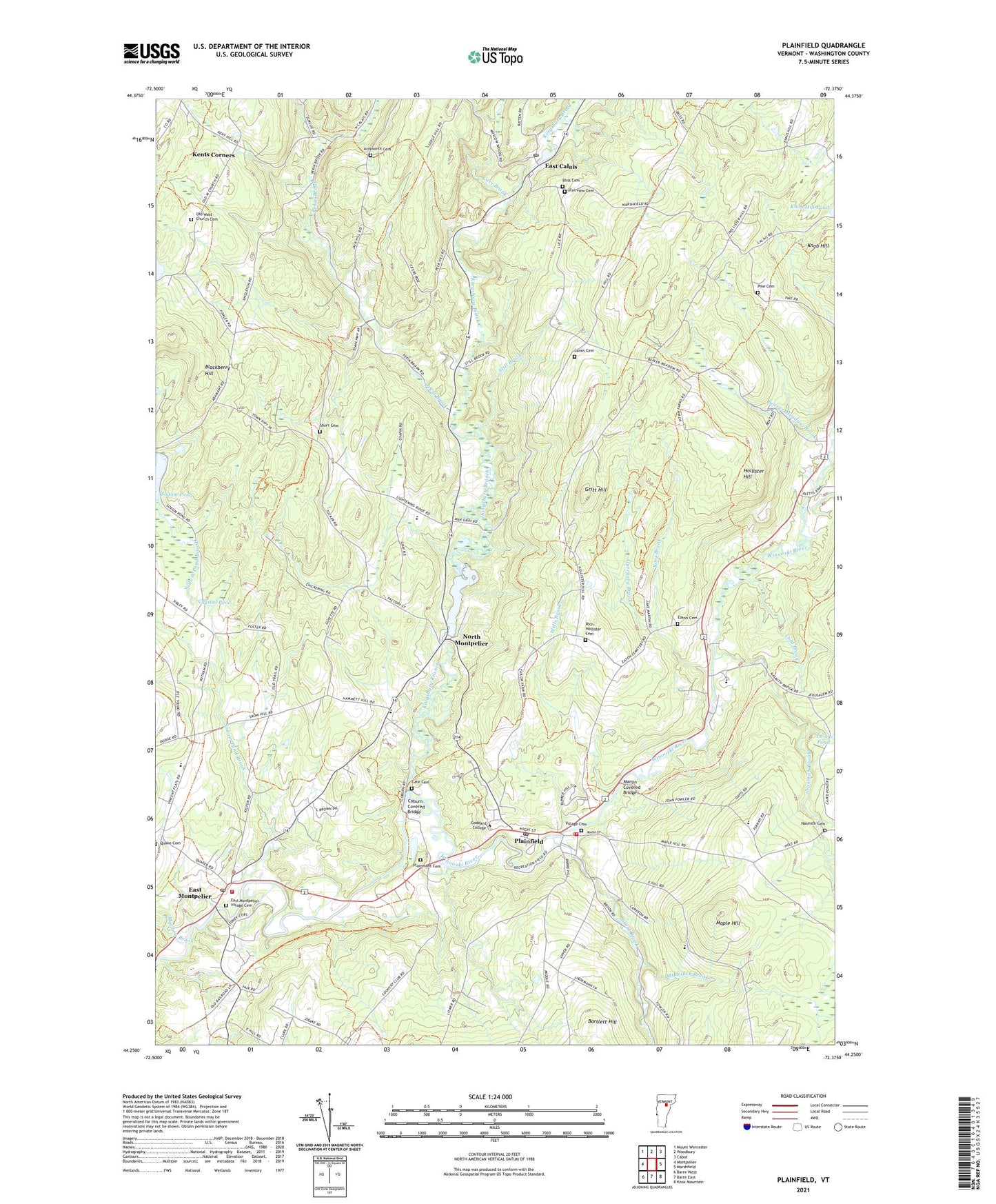
2024 topographic map quadrangle Plainfield in the state of Vermont. Scale: 1:24000. Based on the newly updated USGS 7.5' US Topo map series, this map is in the following counties: Washington. The map contains contour data, water features, and other items you are used to seeing on USGS maps, but also has updated roads and other features. This is the next generation of topographic maps. Printed on high-quality waterproof paper with UV fade-resistant inks.
Quads adjacent to this one:
West: Montpelier
Northwest: Mount Worcester
North: Woodbury
Northeast: Cabot
East: Marshfield
Southeast: Knox Mountain
South: Barre East
Southwest: Barre West
This map covers the same area as the classic USGS quad with code o44072c4.
Contains the following named places: Ainsworth Cemetery, Bartlett Hill, Beaver Meadow Brook, Blackberry Hill, Bliss Cemetery, Calais Elementary School, Calais Town Forest, Carr Brook, Cate Cemetery, Center Cemetery, Center School, Coburn Covered Bridge, Cold Brook, Crystal Pool, Dwinell School, East Calais, East Calais Post Office, East Montpelier, East Montpelier Census Designated Place, East Montpelier Elementary School, East Montpelier Fire Department, East Montpelier Post Office, East Montpelier Village Cemetery, East Village Meeting House, Eaton Cemetery, Fairview Cemetery, Four Corners School, Goddard College, Grace United Methodist Church, Great Brook, Gritt Hill, Guernsey Brook, Hollister Hill, Janes Cemetery, Kent Tavern, Kents Corner Historic District, Kents Corners, Kents Museum, King Brook, King School, Kingsbury Branch, Kingsbury Branch Community School, Kingsbury Brook, Knob Hill, Little Woolen Company Mill, Lye Brook, Mallory Brook, Maple Hill, Martin Covered Bridge, Mskaskek Brook, Nasmith Brook, Nasmith Cemetery, North Montpelier, North Montpelier Pond, North Montpelier Pond Upper Dam, Old West Church, Old West Church Cemetery, Onion River Camp Area, Orchard Valley School, Pekin Brook, Pekin School, Pike Cemetery, Plainfield, Plainfield Census Designated Place, Plainfield Fire and Rescue Department, Plainfield Fire and Rescue Squad, Plainfield Post Office, Plainfield Town Forest, Plainfield Village Historic District, Plainmont Cemetery, Potter Brook, Rich-Hollister Cemetery, Short Cemetery, Sodom Pond, Sodom Pond Brook, Spooners Trailer Park and Campground, Still Brook, The Maplehill School, Town of Calais, Twinfield Union School, Village Cemetery, Washington Northeast Supervisory Union, Wells Brook, WGDR-FM (Plainfield), ZIP Codes: 05640, 05651, 05667