MyTopo
Sterling Mountain Vermont US Topo Map
Couldn't load pickup availability
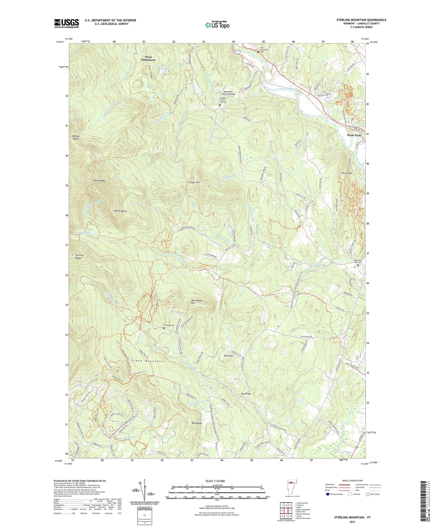
2024 topographic map quadrangle Sterling Mountain in the state of Vermont. Scale: 1:24000. Based on the newly updated USGS 7.5' US Topo map series, this map is in the following counties: Lamoille. The map contains contour data, water features, and other items you are used to seeing on USGS maps, but also has updated roads and other features. This is the next generation of topographic maps. Printed on high-quality waterproof paper with UV fade-resistant inks.
Quads adjacent to this one:
West: Mount Mansfield
Northwest: Jeffersonville
North: Johnson
Northeast: Eden
East: Morrisville
Southeast: Mount Worcester
South: Stowe
Southwest: Bolton Mountain
This map covers the same area as the classic USGS quad with code o44072e6.
Contains the following named places: Bahannan Brook, Beaver Meadow, Beaver Meadow Brook, Belding Pond, Belding Pond Brook, Bidwell - French Hill Cemetery, Boulley Brook, Bull Moose Hill, Caper Hill, Catholic Youth Camp, Church of the Nazarene, Cole School, Daniels Notch, Dry Ridge, Edson Hill Cross Country Ski Center, French Hill Brook, Hall Brook, Harvest Christian School, Jacob Brook, Johnson Village Municipal Forest, Kimibakw Dam, Lamoille Area Vocational Center, Lamoille County, Lamoille North Supervisory Union, Lamoille Union Middle and High School, Morristown Bog Natural Area, Morristown Bog State Forest, Moulds Lodge, Mountain View Cemetery, Mountain View Farm Airport, Mud Brook, Mud City School, Old Catholic Cemetery, Red Bridge, Ross Hill, Roundtop, Sterling Cemetery, Sterling Mountain, Sterling Range, Stowe Municipal Forest, Terrill Hill, Town of Morristown, Waterman Brook, Waterman Covered Bridge, West Settlement, White Face Lodge, White Rocks, WVMX-FM (Stowe)