MyTopo
Newbury Vermont US Topo Map
Couldn't load pickup availability
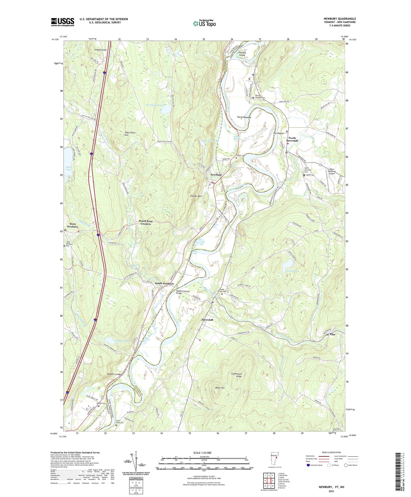
2024 topographic map quadrangle Newbury in the states of New Hampshire, Vermont. Scale: 1:24000. Based on the newly updated USGS 7.5' US Topo map series, this map is in the following counties: Orange, Grafton. The map contains contour data, water features, and other items you are used to seeing on USGS maps, but also has updated roads and other features. This is the next generation of topographic maps. Printed on high-quality waterproof paper with UV fade-resistant inks.
Quads adjacent to this one:
West: East Corinth
Northwest: Groton
North: Woodsville
Northeast: Lisbon
East: East Haverhill
Southeast: Warren
South: Piermont
Southwest: Fairlee
This map covers the same area as the classic USGS quad with code o44072a1.
Contains the following named places: Abbot Cemetery, Ames Plaza Shopping Center, Bailey Eddy, Bayley Historic District, Bedell Covered Bridge, Black Hill, Blackmount Station, Bliss Tavern, Blodgett Dam, Blodgett Pond, Bradford Armory Heliport, Bradford Elementary School, Catamount Ridge, Clark Brook, Conicut Station, Cow Meadow Crossing, Dean Memorial Airport, First Congregational Church, Fish Pond Dam, Grafton County Offices, Grafton Police Department, Halls Brook, Halls Lake, Harriman Brook, Harriman Pond, Haverhill, Haverhill Academy, Haverhill Corner Fire Department, Haverhill Corner Historic District, Haverhill Police Department, Haverhill Post Office, Horse Meadow, Horse Meadow Cemetery, Howard Island, Ladd Street Cemetery, Leighton Hill, Morris Brook, Newbury, Newbury Christian School, Newbury Elementary School, Newbury Historic District, Newbury Post Office, Newbury Volunteer Fire Department Newbury Village Station, Newbury Volunteer Fire Department West Newbury Station, North Haverhill, North Haverhill Cemetery, North Haverhill Census Designated Place, North Haverhill Fire Department, North Haverhill Post Office, North Haverhill United Methodist Church, Oliverian Brook, Oxbow Cemetery, Oxbow High School, Ox-Bow Meadows, Peach Brook, Peach Four Corners, Pearson Hall, Pike, Pike Post Office, Pulaski Mountain, River Road Cemetery, Riverbend Career and Technical Center, Roaring Brook, Sawyer Cemetery, Sawyers Ledge, South Newbury, South Newbury Village Historic District, Tenney Memorial Library, The Fish Pond, The Oxbow, Town Farm Hill, Town Farm School, Town of Newbury, Trinity Church of the Nazarene, Village of Newbury, Walker Oliverian Stream Dam, West Newbury, West Newbury Cemetery, West Newbury Congregational Church, West Newbury Post Office, Wood Pond, ZIP Codes: 03765, 05051, 05081