MyTopo
Peacham Vermont US Topo Map
Couldn't load pickup availability
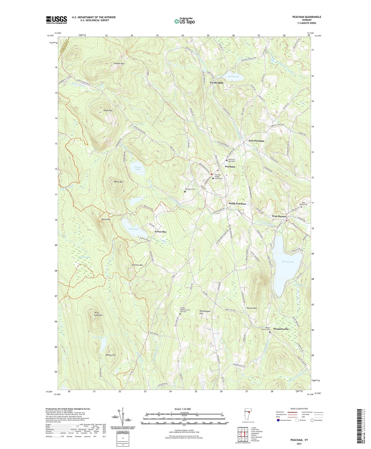
2021 topographic map quadrangle Peacham in the state of Vermont. Scale: 1:24000. Based on the newly updated USGS 7.5' US Topo map series, this map is in the following counties: Caledonia, Washington. The map contains contour data, water features, and other items you are used to seeing on USGS maps, but also has updated roads and other features. This is the next generation of topographic maps. Printed on high-quality waterproof paper with UV fade-resistant inks.
Quads adjacent to this one:
West: Marshfield
Northwest: Cabot
North: Joes Pond
Northeast: Saint Johnsbury
Southeast: Woodsville
South: Groton
Southwest: Knox Mountain
Contains the following named places: Barnet Fire Department - Substation, Devils Hill, East Hill School, East Peacham, East Peacham Baptist Church, Ewell Pond, Ewell Pond Dam, Ewells Mills, Fosters Pond, Green Bay, Groton - Peacham Town Line Cemetery, Harvey Lake, Harvey Mountain, Harveys Lake Dam, Highland Green Camp, Jennison Mountain, Jerry Lund Mountain, Jewett Brook, Jewett Pond, Levi Pond, Levi Pond Wildlife Management Area, Lookout Mountain, Macks Mountain, Martins Pond, Martins Pond Dam, Morse Mountain, Mosquitoville, Mud Pond, Old Covenanter Church, Peacham, Peacham Bog, Peacham Bog Trail, Peacham Census Designated Place, Peacham Congregational Church, Peacham East Cemetery, Peacham Elementary School, Peacham Fire District Forest, Peacham Library, Peacham Municipal Forest, Peacham Post Office, Peacham Village Cementery, Peacham Volunteer Fire Department, Penny Street School, Ricker Campground, Ricker Recreational Area, School Number 6, South Peacham, Stevens School, Town of Peacham, Walter Harvey Cemetery, Walter Harvey School, Wesson Hill, West Barnet, West Barnet Cemetery, Witherspoon Hills, Worcester Cemetery, ZIP Code: 05862