MyTopo
Sunderland Vermont US Topo Map
Couldn't load pickup availability
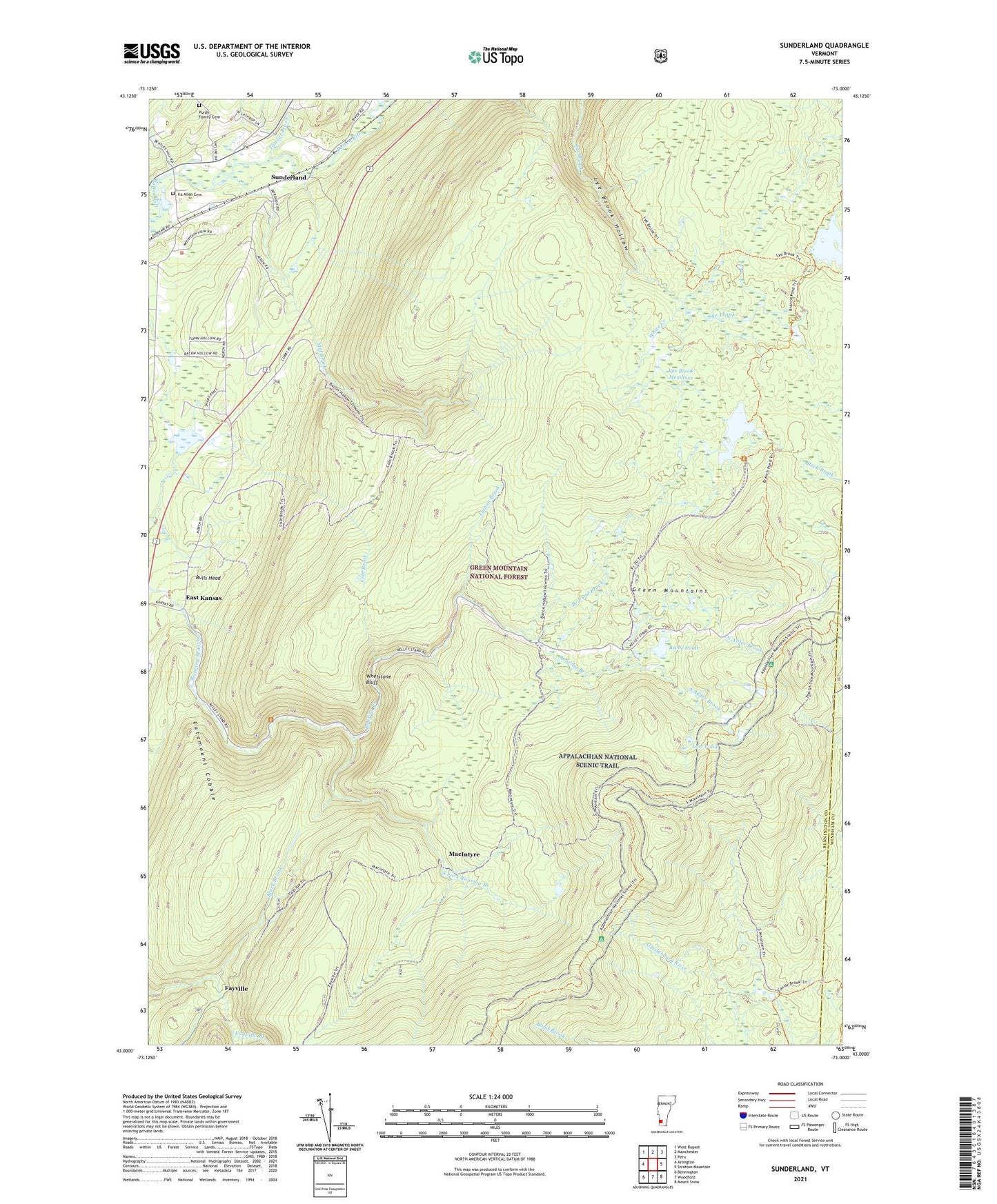
2021 topographic map quadrangle Sunderland in the state of Vermont. Scale: 1:24000. Based on the newly updated USGS 7.5' US Topo map series, this map is in the following counties: Bennington, Windham. The map contains contour data, water features, and other items you are used to seeing on USGS maps, but also has updated roads and other features. This is the next generation of topographic maps. Printed on high-quality waterproof paper with UV fade-resistant inks.
Quads adjacent to this one:
West: Arlington
Northwest: West Rupert
North: Manchester
Northeast: Peru
East: Stratton Mountain
Southeast: Mount Snow
South: Woodford
Southwest: Bennington
Contains the following named places: Beebe Pond, Bennington County, Black Brook, Bourn Pond, Bourn Shelter, Branch Pond, Branch Pond Brook, Branch Pond Trail, Bulls Head, Catamount Cobble, Caughnawaga Shelter, Cole Brook, East Kansas, Fayville, Glastenbury, Ira Allen Cemetery, Kelley Stand, Kid Gore Shelter, Lost Pond, Lye Brook Meadows, Lye Brook Trail, Lye Brook Wilderness, Lyman Brook, MacIntyre, Mill Brook, Mount Equinox Skyline Drive Point of Interest, North Alder Brook, Ondawa 4-H Camp, Purdy Family Cemetery, South Alder Brook, South Bourn Shelter, South Fork Roaring Branch, Story Spring Shelter, Sunderland, Sunderland Church, Sunderland Station, Tanner Brook, The Burning, Town of Sunderland, Whetstone Bluff, White Creek, ZIP Code: 05252