MyTopo
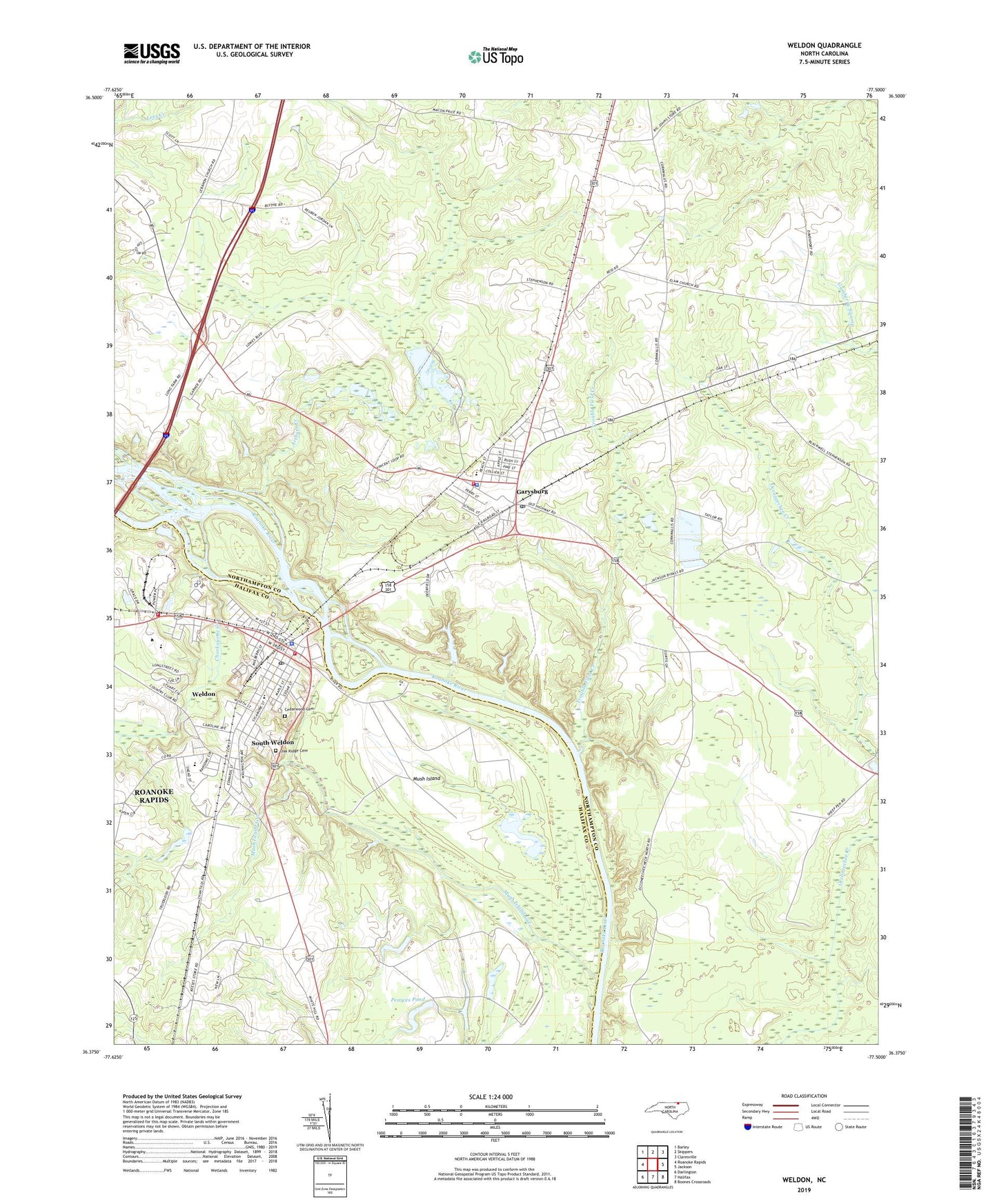
Weldon North Carolina US Topo Map
Couldn't load pickup availability
2022 topographic map quadrangle Weldon in the state of North Carolina. Scale: 1:24000. Based on the newly updated USGS 7.5' US Topo map series, this map is in the following counties: Northampton, Halifax. The map contains contour data, water features, and other items you are used to seeing on USGS maps, but also has updated roads and other features. This is the next generation of topographic maps. Printed on high-quality waterproof paper with UV fade-resistant inks.
Quads adjacent to this one:
West: Roanoke Rapids
Northwest: Barley
North: Skippers
Northeast: Claresville
East: Jackson
Southeast: Boones Crossroads
South: Halifax
Southwest: Darlington
This map covers the same area as the classic USGS quad with code o36077d5.
Contains the following named places: Arthurs Creek, Cedarwood Cemetery, Chapel Grove Church, Chockoyotte Creek, Garysburg, Garysburg Elementary School, Garysburg Fire Department, Garysburg Police Department, Garysburg Post Office, Grace Church, Gumberry School, Mush Island, Mush Island Gut, Oak Grove Church, Oak Ridge Cemetery, Pearce Pond Dam, Pearces Pond, Roanoke Chapel, Roanoke-Salem Church, Saint Johns Church, South Weldon, South Weldon Census Designated Place, Town of Garysburg, Town of Weldon, Township of Oconeechee, Trouble Field Creek, Weldon, Weldon Elementary School, Weldon Fire Department Station 1 Headquarters, Weldon Fire Department Station 2, Weldon High School, Weldon Police Department, Weldon Post Office, WSMY-AM (Weldon), ZIP Codes: 27831, 27890