
MyTopo
Bath Alum Virginia US Topo Map
Couldn't load pickup availability
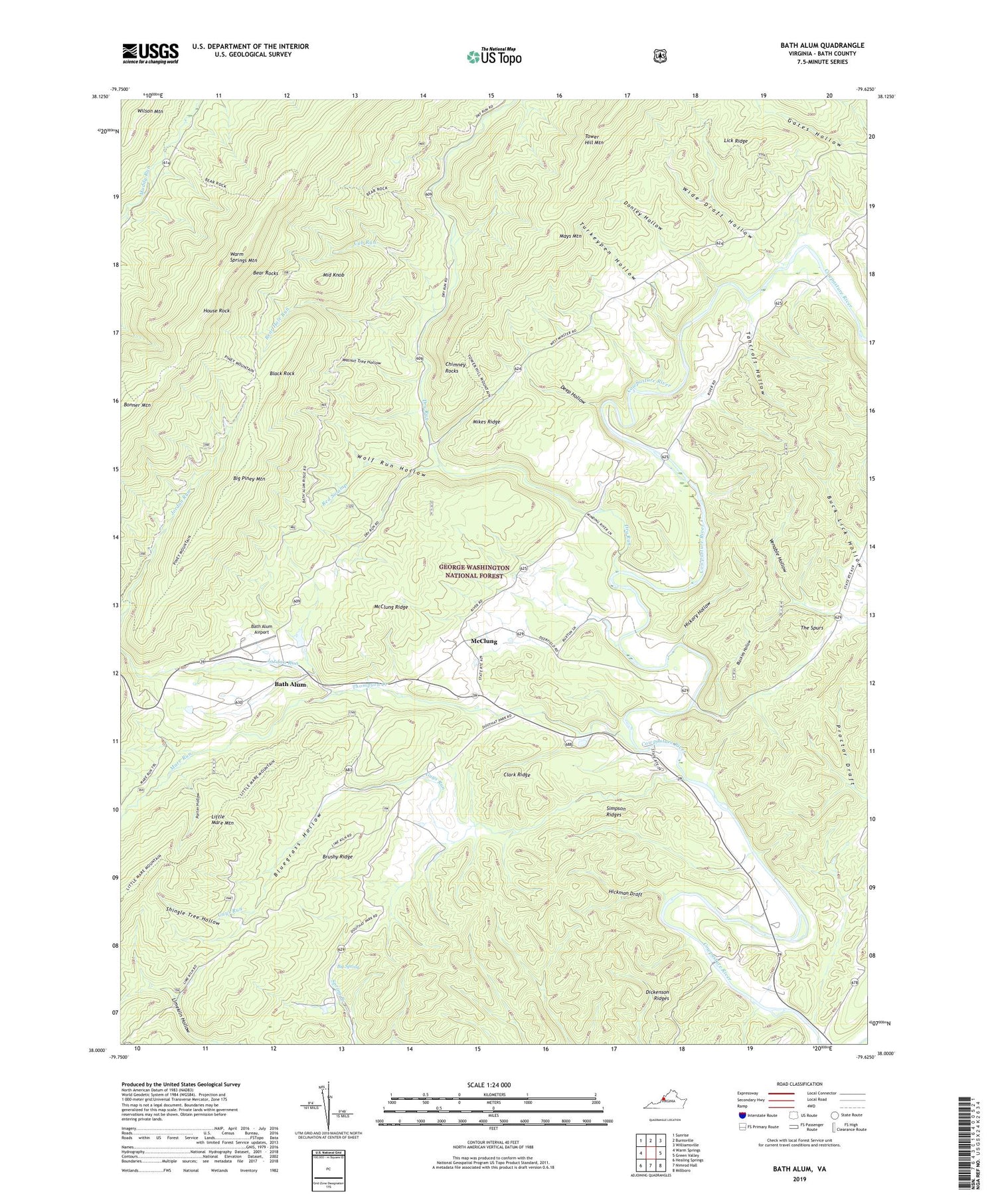
2019 topographic map quadrangle Bath Alum in the state of Virginia. Scale: 1:24000. Based on the newly updated USGS 7.5' US Topo map series, this map is in the following counties: Bath. The map contains contour data, water features, and other items you are used to seeing on USGS maps, but also has updated roads and other features. This is the next generation of topographic maps. Printed on high-quality waterproof paper with UV fade-resistant inks.
Quads adjacent to this one:
West: Warm Springs
Northwest: Sunrise
North: Burnsville
Northeast: Williamsville
East: Green Valley
Southeast: Millboro
South: Nimrod Hall
Southwest: Healing Springs
Contains the following named places: Aviation Golf and Farm Club Dam, Bath Alum, Bath Alum Airport, Bath Alum Camp, Bath County, Bear Hole Run, Bear Rock Trail, Bear Rocks, Big Piney Mountain, Big Spring, Black Rock, Blackies Hollow, Bluegrass Hollow, Brushy Ridge, Camp Kannata, Chimney Rocks, Clark Ridge, Cub Run, Deep Hollow, Dickenson Ridges, Donley Hollow, Dry Run, Fayette County Hunting and Fishing Club, Guys Run, Hickman Draft, Hickory Hollow, House Rock, Jordan Run, Lake of the Pines, Lick Ridge, Mare Run, Mays Mountain, McClung, McClung Ridge, Middle Knob, Mikes Ridge, Porter Hollow, Red Swamp, Shiloh, Shiloh United Methodist Church, Shingle Tree Hollow, Simpson Ridges, South Piney Mountain Trail, Tancroft Hollow, The Spurs, Thompson Creek, Turkeypen Hollow, Venable Hollow, Walnut Tree Hollow, Warm Springs Mountain Trail, Westminister Chapel, Wide Draft Hollow, Williamsville District, Windy Cove Presbyterian Church, Wolf Run Hollow, Woodland Presbyterian Church, ZIP Code: 24460


