MyTopo
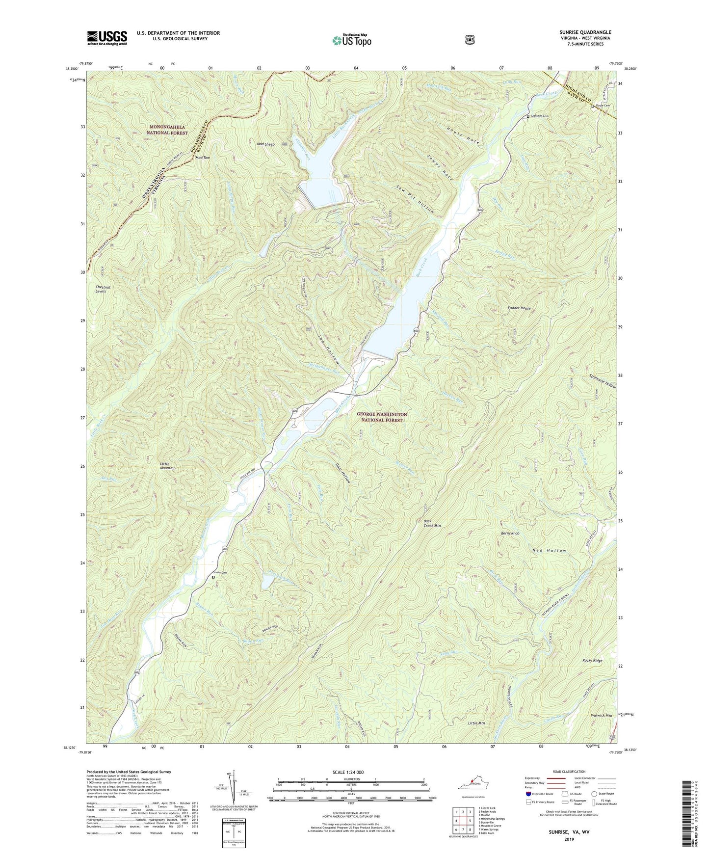
Sunrise Virginia US Topo Map
Couldn't load pickup availability
Also explore the Sunrise Forest Service Topo of this same quad for updated USFS data
2022 topographic map quadrangle Sunrise in the state of Virginia. Scale: 1:24000. Based on the newly updated USGS 7.5' US Topo map series, this map is in the following counties: Bath, Pocahontas, Highland. The map contains contour data, water features, and other items you are used to seeing on USGS maps, but also has updated roads and other features. This is the next generation of topographic maps. Printed on high-quality waterproof paper with UV fade-resistant inks.
Quads adjacent to this one:
West: Minnehaha Springs
Northwest: Clover Lick
North: Paddy Knob
Northeast: Mustoe
East: Burnsville
Southeast: Bath Alum
South: Warm Springs
Southwest: Mountain Grove
Contains the following named places: Bath County Pumped Storage Lake, Beaver Run, Berry Knob, Birch Run, Bogan Run, Castle Run, Chestnut Levels, Dam Hollow, Doyle Cemetery, Dry Run, Fodder House, Ford Run, Gap Run, Hacken Run, House Hole, Jewel Hole, Joe Hollow, Kelly Run, Lightner Cemetery, Lightner Run, Little Mountain, Long Run, Long Spring Run, Mad Sheep, Mad Tom, Mud Lick Run, Ned Hollow, Paddy Lick, Pole Run, Port Lock Run, Saw Pit Hollow, Sawmill Run, Schoolhouse Run, Sively Cemetery, Spring Run, Springhouse Run, Sunrise, Wildcat Hollow, Zion Hill Church, ZIP Code: 24484