MyTopo
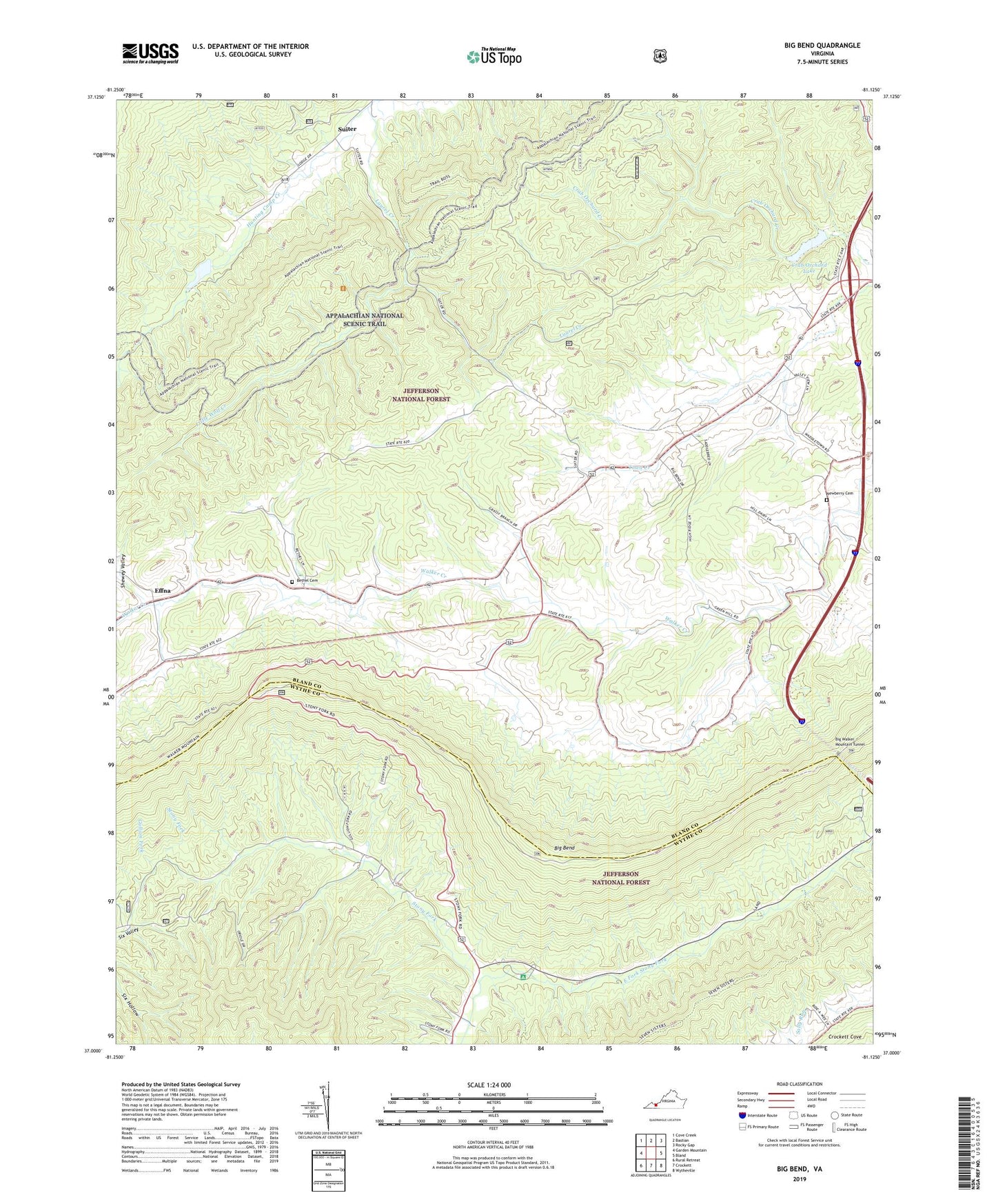
Big Bend Virginia US Topo Map
Couldn't load pickup availability
Also explore the Big Bend Forest Service Topo of this same quad for updated USFS data
2022 topographic map quadrangle Big Bend in the state of Virginia. Scale: 1:24000. Based on the newly updated USGS 7.5' US Topo map series, this map is in the following counties: Bland, Wythe. The map contains contour data, water features, and other items you are used to seeing on USGS maps, but also has updated roads and other features. This is the next generation of topographic maps. Printed on high-quality waterproof paper with UV fade-resistant inks.
Quads adjacent to this one:
West: Garden Mountain
Northwest: Cove Creek
North: Bastian
Northeast: Rocky Gap
East: Bland
Southeast: Wytheville
South: Crockett
Southwest: Rural Retreat
This map covers the same area as the classic USGS quad with code o37081a2.
Contains the following named places: Bethel Cemetery, Big Bend, Big Bend Picnic Area, Big Walker Mountain Tunnel, Crab Orchard Creek Dam, Crab Orchard Lake, Dear Trail Park Campground, Eagle Oak, East Fork Stony Fork, Effna, Green Hill Church, Greenhill School, Griffith Knob, Hunting Camp Creek Wilderness, Hunting Camp Dam, Laurel Creek, Liberty Church, Liberty School, Little Walker Mountain, Little Wolf Creek, Newberry Cemetery, Original Stony Fork Church, Robinetts Store, Stony Fork Campground, Stony Fork Church, Suiter, Suiter School, Suitor, Trinity Church, Walker Mountain, Walker Mountain Lookout, Walker Mountain Trail